-
You are here:
- Homepage »
- Switzerland »
- Bern » Kandersteg

Kandersteg Destination Guide
Discover Kandersteg in Switzerland
Kandersteg in the region of Bern with its 1,123 habitants is a town located in Switzerland - some 33 mi or ( 53 km ) South of Berne , the country's capital .
Local time in Kandersteg is now 05:14 PM (Thursday) . The local timezone is named " Europe/Zurich " with a UTC offset of 1 hours. Depending on your flexibility, these larger cities might be interesting for you: Zurich, Saxeten, Leissigen, Kiental, and Griesalp. When in this area, you might want to check out Zurich . We found some clip posted online . Scroll down to see the most favourite one or select the video collection in the navigation. Are you looking for some initial hints on what might be interesting in Kandersteg ? We have collected some references on our attractions page.
Videos
BLS - Bern Lötschberg Simplon
BLS - Bern Lötschberg Simplon at Brig, Kandersteg, Mülenen Canton of Bern Switzerland ..
Lötschberg car transportation, Kandersteg-Goppenstein, Switzerland
15 August 2010. ..
2 - Dhammapala Kandersteg Spiez Sommer 2009
A collection of pictures taken in the Dhammapala Kloster and its surroundings. Pictures include the award winning... origami Buddhas by Kathrin Schertenleib as well as glaciers, lakes, people, adventu ..
Tobogganing in switzerland
Hadliegh Sea Scouts, in Kandersteg-Switzerland Tobogganing ..
Videos provided by Youtube are under the copyright of their owners.
Interesting facts about this location
Kandersteg International Scout Centre
Kandersteg International Scout Centre (KISC) is an international Scout centre in Kandersteg, Switzerland. The centre provides lodges, chalets and campsites covering 17 hectares of land. It is open to Scouts year round, as well as to non-Scouts for most of the year. More than 11,000 young people from over 40 different countries visit the centre every year. KISC is one of the three World Scout Centres of the World Organization of the Scout Movement (WOSM).
Located at 46.48 7.66 (Lat./Long.); Less than 1 km away
Oeschinen Lake
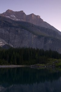
Oeschinen Lake is a lake in the Bernese Oberland, Switzerland, 4 kilometres east of Kandersteg in the Oeschinen valley. At an elevation of 1,578 metres, it has a surface area of 1.1147 square kilometres . Its maximum depth is 56 metres . The lake is fed through a series of mountain creeks and drains underground. The water then re-surfaces as the Oeschibach. Part of it is captured for electricity production and as water supply for Kandersteg.
Located at 46.50 7.73 (Lat./Long.); Less than 4 km away
Blausee
Blausee is a small lake in the Kander valley above Kandergrund at 887 m, near the river Kander. Administratively, it belongs to the Bernese Oberland. The lake has an area of 0.64 ha. The lake can be reached by bus from the train stations of Frutigen or Kandersteg. It is a popular tourist destination. \t\t \t\t\tBlausee (Berner Oberland) im Winter. jpg
Located at 46.53 7.66 (Lat./Long.); Less than 4 km away
Lötschberg Tunnel
The Lötschberg Tunnel is a 14.6 km long railway tunnel on the Lötschberg Line, which connects Spiez and Brig at the northern end of the Simplon Tunnel cutting through the Alps of Switzerland. Its ends are at the towns of Kandersteg in the Canton of Berne and Goppenstein in the Canton of Valais. Construction began in 1906 and suffered delays by several severe accidents. In February 1908, an avalanche destroyed a hotel the workers lived in, killing 13.
Located at 46.43 7.72 (Lat./Long.); Less than 8 km away
Tschingelsee
Tschingelsee is a lake in the valley Kiental of the Canton of Berne, Switzerland. It formed on Tschingelalp in 1972 after severe weather. Since 1987, the area is a nature preserve.
Located at 46.55 7.74 (Lat./Long.); Less than 8 km away
Pictures
Historical Weather
Related Locations
Information of geographic nature is based on public data provided by geonames.org, CIA world facts book, Unesco, DBpedia and wikipedia. Weather is based on NOAA GFS.


