-
You are here:
- Homepage »
- United Kingdom »
- England » Landewednack

Landewednack Destination Guide
Explore Landewednack in United Kingdom
Landewednack in the region of England is a place in United Kingdom - some 246 mi or ( 396 km ) South-West of London , the country's capital city .
Time in Landewednack is now 01:03 AM (Monday) . The local timezone is named " Europe/London " with a UTC offset of 0 hours. Depending on your budget, these more prominent locations might be interesting for you: Truro, Sheffield, Saint Martins Green, Saint Keverne, and Porthleven. Since you are here already, consider visiting Truro . We saw some hobby film on the internet . Scroll down to see the most favourite one or select the video collection in the navigation. Where to go and what to see in Landewednack ? We have collected some references on our attractions page.
Videos
Lizard Point Cornwall
Filmed on a bright and breezy Saturday Easter 2009. It shows the Lighthouse as well as the Old Lifeboat Station at The Lizard. This is the most southerly point in Britain. More video Clips of Cornwall ..
2E0HTS at the Marconi centre & Goonhilly, Cornwall
During our recent holiday trip to Cornwall we managed to visit Goonhilly and The Marconi Centre where I got to play some portable/mobile ham radio from the historic site. The video shows the Marconi C ..
ANOTHER BLOB OF CORNISH CLOTTED CREAM - WE'RE OFF TO SEE THE LIZARD
....actually Lizard Point - the most southerly point of the British mainland, and the scene of the RNLI's largest rescue mission in 1907 (16 June 2011) For more Cornwall videos see www.youtube.com ..
Cornwall - Two Sides of Kynance Cove
Moody in December 2008 and calm in October 2010 ..
Videos provided by Youtube are under the copyright of their owners.
Interesting facts about this location
Pentreath
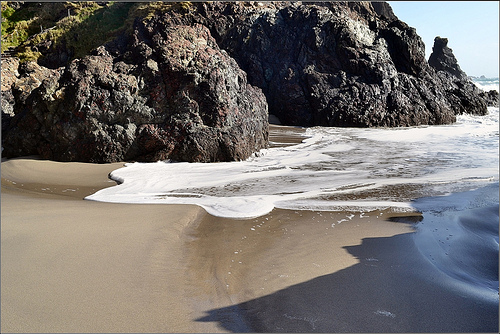
Pentreath (Cornish: Pentreth, meaning head of a beach) is a hamlet west of Praa Sands, between Penzance and Helston in Cornwall, England, United Kingdom. Pentreath Beach is also small cove with a beach, not far away in south-west Cornwall, England, United Kingdom. It is situated on the west side of the Lizard Peninsula, 200 metres south of Kynance Cove. Access is via a steep cliff path cut into the cliffs.
Located at 49.97 -5.22 (Lat./Long.); Less than 1 km away
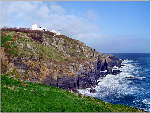
Lizard Lighthouse
The Lizard Lighthouse is a lighthouse at Lizard Point in Cornwall, United Kingdom, built to guide vessels passing through the English Channel. A light was first exhibited here in 1619, built thanks to the efforts of Sir John Killigrew, but it was extinguished and the tower demolished in 1630 because of difficulties in raising funds for its operation and maintenance. The current lighthouse, consisting of two towers with cottages between them, was built in 1751.
Located at 49.96 -5.20 (Lat./Long.); Less than 1 km away
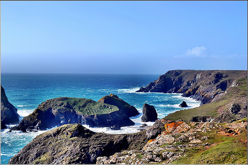
Kynance Cove
Kynance Cove (Cornish: Porth Keynans, meaning ravine cove) is a cove in southwest Cornwall, United Kingdom. It is situated on the Lizard peninsula approximately two miles (3 km) north of Lizard Point. Kynance Cove and the surrounding coast are owned by the National Trust. The cove became popular in the early Victorian era, with many distinguished visitors including Alfred Lord Tennyson. The BBC has described Kynance Cove as "one of the most beautiful stretches of coastline in the South West.
Located at 49.97 -5.23 (Lat./Long.); Less than 1 km away
Battle at The Lizard
The naval Battle of the Lizard (French: Combat du Cap Lézard) took place on 21 October 1707 during the War of the Spanish Succession near Lizard Point, Cornwall between two French squadrons under René Duguay-Trouin and Claude de Forbin and an English convoy protected by a squadron under Commodore Richard Edwards. Duguay-Trouin and Forbin were two of the most successful French naval commanders and they had caused much damage to the allied merchant fleet.
Located at 49.95 -5.21 (Lat./Long.); Less than 2 km away
Grade–Ruan
Grade–Ruan is a civil parish on the Lizard peninsula in Cornwall, England, United Kingdom, approximately ten miles (16 km) south of Falmouth. It is a rural parish bounded to the east by St Keverne parish and by the sea; to the west by Mullion and Cury parishes; and to the south by Landewednack parish. Grade–Ruan civil parish encompasses part of Goonhilly Downs and the major settlements are Ruan Minor, St Ruan and Cadgwith.
Located at 50.00 -5.19 (Lat./Long.); Less than 4 km away
Pictures


Related Locations
Information of geographic nature is based on public data provided by geonames.org, CIA world facts book, Unesco, DBpedia and wikipedia. Weather is based on NOAA GFS.