-
You are here:
- Homepage »
- United Kingdom »
- England » Plaxtol

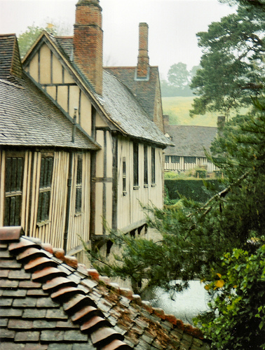
Plaxtol Destination Guide
Delve into Plaxtol in United Kingdom
Plaxtol in the region of England is located in United Kingdom - some 25 mi or ( 40 km ) South-East of London , the country's capital .
Local time in Plaxtol is now 10:31 AM (Friday) . The local timezone is named " Europe/London " with a UTC offset of 0 hours. Depending on your mobility, these larger destinations might be interesting for you: Swanley, London Borough of Sutton, Southend-on-Sea, Shipborne, and Seal. While being here, you might want to check out Swanley . We discovered some clip posted online . Scroll down to see the most favourite one or select the video collection in the navigation. Are you curious about the possible sightseeing spots and facts in Plaxtol ? We have collected some references on our attractions page.
Videos
Class 377 electrostar
A class 377 southern electrostar (with south eastern refurbishment) running on the line from tunbridge to redhill. benobve.110mb.com ..
South Eastern (pt3 - Final Part)
In this the 3rd & final part of this series, we return back to Tonbridge to see a few more local workings plus a railtour the "Buffer Puffer". The rail tour as seen is top & tailed with a class 31 & c ..
South Eastern (pt1)
Another new location(s) not yet visited by my camera's before. So a change from my normal area, we take a trip down to Kent in the south east of England. Here we see various EMU's from South Eastern r ..
River Medway Tonbridge spate 24Jan09
River Medway at Tonbridge Kent UK at high level after a period of heavy rain, showing river between Tonbridge Castle and Town Lock in full spate 24Jan09. Several still photos included for comparison. ..
Videos provided by Youtube are under the copyright of their owners.
Interesting facts about this location
Old Soar Manor
Old Soar Manor is an English Heritage property, owned and maintained by the National Trust. Located near Plaxtol, Kent, England, it is a small 13th century stone manor house.
Located at 51.26 0.32 (Lat./Long.); Less than 2 km away
Ightham Mote
Ightham Mote (pronounced "item moat") is a medieval moated manor house close to the village of Ightham, near Sevenoaks in Kent. The name "mote" derives from "moot", "meeting [place place]", rather than referring to the body of water. Ightham Mote and its gardens are owned by the National Trust and open to the public.
Located at 51.26 0.27 (Lat./Long.); Less than 2 km away
River Bourne, Kent
|} The River Bourne rises in the parish of Ightham, Kent and flows in a generally south easterly direction through the parishes of Borough Green, Platt, Plaxtol, West Peckham, Hadlow, and East Peckham where it joins the River Medway. In the 18th century the river was known as the Busty or Buster, the Shode or Sheet, but is not known by these names nowadays. A bourne is a type of stream, while shode means a branch of a river.
Located at 51.29 0.29 (Lat./Long.); Less than 3 km away
Oldbury hillfort
Oldbury hillfort is a large Iron Age hill fort near the village of Ightham, Kent, England. It covers the top of a hill that would have provided commanding views over one of the main routes in and out of the Weald and covers an area of 50 ha. A natural spring within the fort would have provided water to the occupants making it a very attractive spot. The eastern side of the hill is very steep and so earthwork defences were constructed only on the other sides.
Located at 51.28 0.26 (Lat./Long.); Less than 3 km away
Tonbridge and Malling (UK Parliament constituency)
Tonbridge and Malling is ya constituency represented in the House of Commons of the UK Parliament since 1974 by Sir John Stanley, a Conservative.
Located at 51.23 0.33 (Lat./Long.); Less than 4 km away
Pictures


Historical Weather
Related Locations
Information of geographic nature is based on public data provided by geonames.org, CIA world facts book, Unesco, DBpedia and wikipedia. Weather is based on NOAA GFS.