-
You are here:
- Homepage »
- United Kingdom »
- England » Southorpe

Southorpe Destination Guide
Delve into Southorpe in United Kingdom
Southorpe in the region of England is located in United Kingdom - some 77 mi or ( 124 km ) North of London , the country's capital .
Local time in Southorpe is now 09:30 PM (Friday) . The local timezone is named " Europe/London " with a UTC offset of 0 hours. Depending on your mobility, these larger destinations might be interesting for you: Water Newton, Uffington, Tinwell, Tallington, and Sutton. While being here, you might want to check out Water Newton . We discovered some clip posted online . Scroll down to see the most favourite one or select the video collection in the navigation. Are you curious about the possible sightseeing spots and facts in Southorpe ? We have collected some references on our attractions page.
Videos
Somerset & Dorset Pines Express - NVR
The Somerset And Dorset Pines Express event at the Nene Valley Railway, on 25th April 2010. BR Standard Class 5, 73050, and LMS 4F, 44422, recreate The Somerset And Dorset Pines Express. Visit the NVR ..
Thomas The Tank Engine at Christmas (Nene Valley Railway Santa Special)
Thomas The Tank Engine, Nene Valley Railway, Wansford, Christmas, Santa ..
BR Standard Class Five, 73050, the 'City Of Peterborough'
www.nvr.org.uk en.wikipedia.org 73050 City Of Peterborough, a British Rail Standard Class Five locomotive at the Nene Valley Railway running the 'Winter Warmers' service between Yarwell and Peterborou ..
Nene Valley Spring Diesel Gala 2010
Nene Valley Railways Diesel Spring Diesel Gala 2010. www.nvr.org.uk Locomotives include: Peak Class 46045 20048 66720 Class 40 D306 Atlantic Conveyor 31108 Class 14 D9516 and 9523 A great day, and not ..
Videos provided by Youtube are under the copyright of their owners.
Interesting facts about this location
Southorpe Meadow
Southorpe Meadow is managed as a nature reserve by the Wildlife Trust for Bedfordshire, Cambridgeshire, Northamptonshire and Peterborough. It lies south of the village of Southorpe in the unitary authority area of Peterborough and has been designated a Site of Special Scientific Interest.
Located at 52.62 -0.40 (Lat./Long.); Less than 1 km away
Southorpe Paddock
Southorpe Paddock is managed as a nature reserve by the Wildlife Trust for Bedfordshire, Cambridgeshire, Northamptonshire and Peterborough. It lies south of the village of Southorpe in the unitary authority area of Peterborough and has been designated a Site of Special Scientific Interest.
Located at 52.61 -0.40 (Lat./Long.); Less than 1 km away
Barnack Hills & Holes National Nature Reserve
Barnack Hills & Holes is managed as a National Nature Reserve and Site of Special Scientific Interest by Natural England, a non-departmental public body vested in 2006. It is situated in the village of Barnack in the unitary authority area of Peterborough in the United Kingdom. There are 222 NNRs in England covering over 350 square miles (900 km²) and practically every kind of landscape. This site has been selected by Natural England as one of its 35 Spotlight Reserves.
Located at 52.63 -0.41 (Lat./Long.); Less than 2 km away
Barnack Rural District
Barnack was a rural district in the Soke of Peterborough and later Huntingdon and Peterborough from 1894 to 1974. It was created in 1894 under the Local Government Act 1894, from that part of the Stamford rural sanitary district which was in the Soke. It included the parishes of Bainton, Barnack, Southorpe, Stamford Baron St Martins Without, Thornhaugh, Ufford, Wansford, Wittering and Wothorpe in the Soke.
Located at 52.63 -0.38 (Lat./Long.); Less than 2 km away
Wansford Pasture
Wansford Pasture is managed as a nature reserve by the Wildlife Trust for Bedfordshire, Cambridgeshire, Northamptonshire and Peterborough. It is designated a Site of Special Scientific Interest and lies to the west of the village of Wansford in the unitary authority area of Peterborough.
Located at 52.58 -0.42 (Lat./Long.); Less than 3 km away
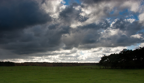
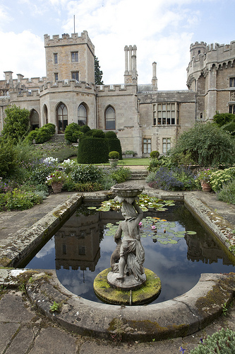
Pictures

Related Locations
Information of geographic nature is based on public data provided by geonames.org, CIA world facts book, Unesco, DBpedia and wikipedia. Weather is based on NOAA GFS.