-
You are here:
- Homepage »
- United States »
- California » Lake of the Pines

Lake of the Pines Destination Guide
Discover Lake of the Pines in United States
Lake of the Pines in the region of California with its 3,917 habitants is a town located in United States - some 2,341 mi or ( 3767 km ) West of Washington , the country's capital .
Local time in Lake of the Pines is now 02:25 AM (Thursday) . The local timezone is named " America/Los Angeles " with a UTC offset of -7 hours. Depending on your flexibility, these larger cities might be interesting for you: Alta Sierra, Alta Sierra Ranches, Auburn, Bakersfield, and Cherry Creek Acres. When in this area, you might want to check out Alta Sierra . We found some clip posted online . Scroll down to see the most favourite one or select the video collection in the navigation. Are you looking for some initial hints on what might be interesting in Lake of the Pines ? We have collected some references on our attractions page.
Videos
How To Find Gold #2 - How to Pan For Gold
www.WhereGoldIs.com This is the second video in our How To Find Gold series. Here we show you the basics of panning for gold so you can go out and start finding gold today! ..
How To Find Gold #5 - How To Set Up a Gold Sluice
www.WhereGoldIs.com This video gives you some important information and tips for setting up a sluice properly. It's so difficult to learn how to run a sluice properly because there are so many variabl ..
How To Find Gold #7 - How To Sluice For Gold, Part 2
www.WhereGoldIs.com This video shows a different style of sluice that is easier to clean and more flexible than most sluices. ..
Winchester Country Club Real Estate
www.placercountyhomesandland.com - This video highlights some of the positive features of Winchester Country Club a luxury golf course community in Meadow Vista, CA. Visit our webpage to view a list o ..
Videos provided by Youtube are under the copyright of their owners.
Interesting facts about this location
Lake of the Pines, California
For the lake in Texas, see Lake O’ the Pines.
Located at 39.04 -121.06 (Lat./Long.); Less than 0 km away
Bear River High School
Bear River High School is a public high school in the Nevada Joint Union High School District in Grass Valley, California. It is located across the street from Lake of the Pines. It graduated approximately 300 graduates in the 2006-2007 school year for a 98.5% graduation rate, 52.1% completed CSU/UC prep. Ethnically 90.6% of the students self-identified as white. Its main rival is Colfax High School located in Colfax, CA, and the annual Bear River vs.
Located at 39.05 -121.08 (Lat./Long.); Less than 2 km away
Meadow Vista, California
Meadow Vista is a census-designated place (CDP) in Placer County, California, United States. It is part of the Sacramento–Arden-Arcade–Roseville Metropolitan Statistical Area. The population was 3,217 at the 2010 census, up from 3,096 at the 2000 census.
Located at 39.00 -121.03 (Lat./Long.); Less than 5 km away
Weimar Center of Health & Education
Weimar Center of Health & Education, historically known as Weimar Institute, is a private educational facility in Weimar, California, which operates an unaccredited high school and college. It highlights traditional Seventh-day Adventist principles of health and education, especially as espoused by early Seventh-day Adventist founder Ellen G. White, who wrote extensively on health and education.
Located at 39.04 -120.98 (Lat./Long.); Less than 7 km away
Auburn Municipal Airport (California)
Auburn Municipal Airport is a public airport located three miles (5 km) north of Auburn, serving Placer County, California, USA. The airport is mostly used for general aviation. The City of Auburn owns and operates the airport. The federal government built the airport in 1934 and used it to support mail service until 1946. In 1947, local residents worked to transfer the airport to the city from the federal government and private land owners.
Located at 38.95 -121.08 (Lat./Long.); Less than 10 km away
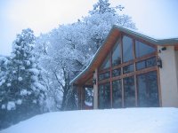
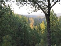
Pictures
Related Locations
Information of geographic nature is based on public data provided by geonames.org, CIA world facts book, Unesco, DBpedia and wikipedia. Weather is based on NOAA GFS.

