-
You are here:
- Homepage »
- United States »
- Illinois » Brooklyn

Brooklyn Destination Guide
Delve into Brooklyn in United States
Brooklyn in the region of Illinois with its 749 residents is a city in United States - some 707 mi or ( 1137 km ) West of Washington , the country's capital .
Current time in Brooklyn is now 04:22 AM (Saturday) . The local timezone is named " America/Chicago " with a UTC offset of -5 hours. Depending on your travel modalities, these larger destinations might be interesting for you: Belleville, Cahokia, Decatur, Dupo, and Eagle Park. While being here, make sure to check out Belleville . We encountered some video on the web . Scroll down to see the most favourite one or select the video collection in the navigation. Are you curious about the possible sightseeing spots and facts in Brooklyn ? We have collected some references on our attractions page.
Videos
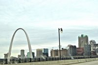
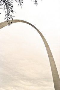
Gateway Arch Tour - A 1 minute visit
A one-minute visit to "Gateway Arch Tour" at Jefferson National Expansion Memorial in St. Louis, Missouri. To learn more, visit www.nps.gov/jeff. For books and DVDs, visit www.jnpa.com. The Arch tower ..
Dover Hydraulic elevator @ east river metrolink station east st louis IL
I only have ONE more T1 vid to upload after this and it is somewhat of a treat. This video is a ride on the metrolink east st louis elevator and a nice view of the city.. enjoy! ..
I-55 South thru Saint Louis
Starting in Illinois and heading southwest down I-55 into St. Louis, Missouri. Music: Mansions on the Moon - Satellite (MotM x Deadmau5) www.facebook.com ..
Green Bay Packers, Week 15 2007 - The Once in a Lifetime Fan
Family road trip to St Louis Missouri to see the Green Bay Packers beat the St Louis Rams. Lots of travel sightseeing and good family times. FromSydney Australia to Green Bay Wisconsin to follow the G ..
Videos provided by Youtube are under the copyright of their owners.
Interesting facts about this location
Brooklyn, Illinois
Brooklyn (popularly known as Lovejoy), is a village in St. Clair County, Illinois, United States. Located just 2 miles north of East St. Louis, Illinois and 3 miles northeast of Downtown St. Louis, Missouri, it is the oldest town incorporated by African Americans in the United States. It has the first African Methodist Episcopal Church, an independent denomination, built west of the Appalachian Mountains and the first in Illinois. Its motto is "Founded by Chance, Sustained by Courage".
Located at 38.66 -90.17 (Lat./Long.); Less than 0 km away
McKinley Bridge
The McKinley Bridge is a steel truss bridge across the Mississippi River. It connects northern portions of the city of St. Louis, Missouri with Venice, Illinois. It opened in 1910 and was taken out of service on October 30, 2001. The bridge was reopened for pedestrian and bicyclists on November 17, 2007 with a grand re-opening celebration. Since December 2007, McKinley has been open to vehicular traffic as well.
Located at 38.67 -90.18 (Lat./Long.); Less than 2 km away
Venice, Illinois
Venice is a city in Madison County, Illinois, United States. The population was 1,890 at the 2010 census. The Venice Power Station, a combustion turbine generator (CTG)-type Ameren power plant, is located in Venice.
Located at 38.67 -90.17 (Lat./Long.); Less than 2 km away
New Mississippi River Bridge
The New Mississippi River Bridge is a bridge under construction across the Mississippi River between St. Clair County, Illinois and the city of St. Louis, Missouri. The structure will relieve traffic on nearby bridges, most importantly the Poplar Street Bridge, which carries I-55, I-64, I-70, and US 40. The bridge is of a cable-stayed design and will have a main span of 1,500 feet (457 m).
Located at 38.64 -90.18 (Lat./Long.); Less than 2 km away
Bloody Island (Mississippi River)
Bloody Island was a sandbar or "towhead" in the Mississippi River, opposite St. Louis, Missouri, which became densely wooded and a rendezvous for duelists because it was considered "neutral" and not under Missouri or Illinois control. Appearing first above water in 1798 its continuous growth menaced the harbor of St. Louis. In 1837 Capt. Robert E. Lee, of U.S.A.
Located at 38.64 -90.17 (Lat./Long.); Less than 2 km away
Pictures
Related Locations
Information of geographic nature is based on public data provided by geonames.org, CIA world facts book, Unesco, DBpedia and wikipedia. Weather is based on NOAA GFS.

