-
You are here:
- Homepage »
- United States »
- Massachusetts » Ocean Bluff-Brant Rock

Ocean Bluff-Brant Rock Destination Guide
Discover Ocean Bluff-Brant Rock in United States
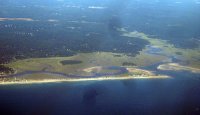
Ocean Bluff-Brant Rock in the region of Massachusetts with its 4,970 habitants is a town located in United States - some 402 mi or ( 646 km ) North-East of Washington , the country's capital .
Local time in Ocean Bluff-Brant Rock is now 05:36 PM (Tuesday) . The local timezone is named " America/New York " with a UTC offset of -4 hours. Depending on your flexibility, these larger cities might be interesting for you: Hartford, Barnstable, Boston, Camp Chappa Challa, and Cohasset. When in this area, you might want to check out Hartford . We found some clip posted online . Scroll down to see the most favourite one or select the video collection in the navigation. Are you looking for some initial hints on what might be interesting in Ocean Bluff-Brant Rock ? We have collected some references on our attractions page.
Videos
Family fun theme park with Story Land TV
2008 Story Land NH Commercial, check out fun rides, food and amusement in New Hampshire ..
Life & Style for Less :: November Highlights
lifeandstyleforless.com :: Your complete source for living well on a budget. Get great tips for home decorating, gardening, entertaining, sewing, fashion, travel, getting healthy and green living. ..
Remote Control Airplane at Sea Gate Brooklyn NYC
Brushless Hobbyzone Super Cub 40 AMP Hobbywing spped cotroller with BEC from hobbypartz Turnigy 3S 1300mah 20-30 C Battery from hobbyking 10X7 Propeller from hobbyking Turnigy 1000KV brushless motor C ..
Diving in Misery Cove, North shore, MA
New England diving is rough...not the best Viz, murky water, and it's COLD. But, if you love it, you love it. That's right, we're bad-ass ;) (PS, I filmed this video with my bad-ass marine camera.) ..
Videos provided by Youtube are under the copyright of their owners.
Interesting facts about this location
Ocean Bluff-Brant Rock, Massachusetts
Ocean Bluff-Brant Rock is a census-designated place (CDP) in Plymouth County, Massachusetts, United States, composed of the villages of Ocean Bluff and Brant Rock in the town of Marshfield. The population was 4,970 at the 2010 census.
Located at 42.10 -70.66 (Lat./Long.); Less than 0 km away
Marshfield Municipal Airport (Massachusetts)
Marshfield Municipal Airport, also known as George Harlow Field, is a public airport located 2 mi (3 km) east of the central business district (CBD) of Marshfield, a town in Plymouth County, Massachusetts, USA. The airport is owned by the Town of Marshfield and run by Shoreline Aviation, the airport's fixed base operator (FBO). It has one runway (06-24), averages 50 movements per day, and has approximately 48 aircraft based on its field.
Located at 42.10 -70.67 (Lat./Long.); Less than 1 km away
Green Harbor, Massachusetts
Green Harbor-Cedar Crest is a census-designated place (CDP) in the towns of Marshfield in Plymouth County, Massachusetts, United States. It includes the village of Green Harbor. Cedar Crest is the name of a hill located on the north side of Careswell St. The population was 2,609 at the 2010 census.
Located at 42.07 -70.66 (Lat./Long.); Less than 3 km away
Marshfield (CDP), Massachusetts
Marshfield is a census-designated place (CDP) in the town of Marshfield in Plymouth County, Massachusetts, United States. The population was 4,335 at the 2010 census.
Located at 42.09 -70.71 (Lat./Long.); Less than 4 km away
Humarock
Humarock (often called Humarock Beach or Humarock Island) is part of Scituate, Massachusetts, United States {{#invoke:Coordinates|coord}}{{#coordinates:42|08|10|N|70|41|26|W|type:city_region:US-MA_source:gnis |primary |name= }}. Humarock is a pictureque seaside village surrounded by water and situated on Cape Cod Bay midway between Boston and Plymouth. It was separated from the rest of the town in the Portland Gale of 1898 in which the mouth of the North River shifted.
Located at 42.14 -70.69 (Lat./Long.); Less than 5 km away
Pictures
Related Locations
Information of geographic nature is based on public data provided by geonames.org, CIA world facts book, Unesco, DBpedia and wikipedia. Weather is based on NOAA GFS.

