-
You are here:
- Homepage »
- United States »
- New Mexico » Sandia Heights

Sandia Heights Destination Guide
Discover Sandia Heights in United States
Sandia Heights in the region of New Mexico with its 3,193 habitants is a town located in United States - some 1,637 mi or ( 2635 km ) West of Washington , the country's capital .
Local time in Sandia Heights is now 05:01 PM (Wednesday) . The local timezone is named " America/Denver " with a UTC offset of -6 hours. Depending on your flexibility, these larger cities might be interesting for you: Colorado Springs, Pueblo, Albuquerque, Bernalillo, and Cedar Crest. When in this area, you might want to check out Colorado Springs . We found some clip posted online . Scroll down to see the most favourite one or select the video collection in the navigation. Are you looking for some initial hints on what might be interesting in Sandia Heights ? We have collected some references on our attractions page.
Videos
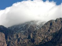
Sandia Mountains New Mexico
This is a video clip I took of the Sandia Mountains toward sundown on November 20 2007. It was taken from the Elena Gallegos Picnic Grounds which is in the foothills. The Sandia's border right up agai ..
Sandia Mountains Albuquerque North Crest Trail
A few video clips taken in early June 2008 walking along the North Crest Trail at the top of the Sandia Mountains next to Albuquerque New Mexico. No matter what time of day or of year and how much tim ..
Money Tips in Animal Crossing City Folk
Some ways I make money in Animal Crossing City Folk ..
Jumping Head
I took this video on my last trip to USA. i was just driving around in a car and i've spotted this man in a last moment to point my camera on him. i guess it was cross country team from La Cueva High ..
Videos provided by Youtube are under the copyright of their owners.
Interesting facts about this location
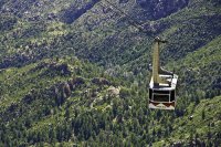
Sandia Peak Tramway
The Sandia Peak Tramway is located adjacent to Albuquerque, New Mexico, USA. It stretches from the northeast edge of the city to the crestline of the Sandia Mountains and has the world's third longest single span.
Located at 35.19 -106.48 (Lat./Long.); Less than 2 km away
KRQE
KRQE, digital channel 13, is the CBS-affiliated television station serving the Albuquerque, New Mexico television market; the station is owned by the LIN TV Corporation and is sister station to Fox affiliate KASA-TV (channel 2). Its transmitter is located on Sandia Crest, east of Albuquerque.
Located at 35.21 -106.45 (Lat./Long.); Less than 5 km away
KLUZ-TV
KLUZ-TV is a television station in Albuquerque, New Mexico. It is a Univision affiliate, owned by Entravision Communications Corporation. KLUZ began operation in September 1987 and has been a Univision affiliate since then. In 2007 it added LATV as a digital subchannel on 41.2. KLUZ operates on digital channel 42 and is displayed as channel 41.
Located at 35.21 -106.45 (Lat./Long.); Less than 5 km away
KOB
The kob (Kobus kob) is an antelope found across sub-Saharan Africa from Senegal to South Sudan. Found along the northern savanna, it is often seen in Murchison Falls and Queen Elizabeth National Park, Uganda; Garamba and Virunga National Park, and the Democratic Republic of the Congo, as well as grassy floodplains of South Sudan. Kob are found in wet areas, where they eat grasses. Kob are diurnal, but inactive during the heat of the day.
Located at 35.21 -106.45 (Lat./Long.); Less than 5 km away
KKOB-FM
KKOB-FM is an FM radio station based in Albuquerque, New Mexico, owned by Cumulus Media. It broadcasts on 93.3 MHz and has a Top 40 format in competition with similar-formatted rival KDLW and Rhythmic Top 40 rivals KKSS and KAGM for listeners in that market. Its brand is "93.3 KOB-FM - The Pop Music Channel. " The station plays today's top hits with each song ending with a "pop tag" in which a female voice names the artist and song title.
Located at 35.21 -106.45 (Lat./Long.); Less than 5 km away
Pictures
Related Locations
Information of geographic nature is based on public data provided by geonames.org, CIA world facts book, Unesco, DBpedia and wikipedia. Weather is based on NOAA GFS.

