-
You are here:
- Homepage »
- United States »
- Utah » Tropic

Tropic Destination Guide
Touring Tropic in United States
Tropic in the region of Utah with its 530 citizens is located in United States - some 1,892 mi or ( 3044 km ) West of Washington , the country's capital city .
Time in Tropic is now 02:01 PM (Thursday) . The local timezone is named " America/Denver " with a UTC offset of -6 hours. Depending on your budget, these more prominent places might be interesting for you: Flagstaff, Las Vegas, Beaver, Bryce Canyon, and Georgetown. Being here already, consider visiting Flagstaff . We collected some hobby film on the internet . Scroll down to see the most favourite one or select the video collection in the navigation. Check out our recommendations for Tropic ? We have collected some references on our attractions page.
Videos
Hotel Cooking
blog.curioussouls.com ..
Bryce canyon NP Navajo Loop Trail 3
ブライスキャニオン国立公園ナバホループトレイル、リスのおまけ。PART3 ..
Desert SW Family Vacation '08, Day 3
Bryce Canyon National Park and then on to Moab, UT ..
Leslie rides the road
Southern Utah - September 2008 On the way to Bryce Canyon, from Cannonville to Panguitch ..
Videos provided by Youtube are under the copyright of their owners.
Interesting facts about this location
United Airlines Flight 608
United Airlines Flight 608 was a Douglas DC-6 airliner, registration NC37510, on a scheduled passenger flight from Los Angeles to Chicago when it crashed at 12:29 pm on October 24, 1947 about 1.5 miles southeast of Bryce Canyon Airport, Utah. There were no survivors among the 5 crew members and 47 passengers on board. It was the first crash of a DC-6, and at the time it was the second deadliest air crash in the United States, surpassed by Eastern Air Lines Flight 605 by only one fatality.
Located at 37.69 -112.14 (Lat./Long.); Less than 8 km away
Bryce Canyon Airport
Bryce Canyon Airport is a public airport located four miles (6 km) north of Bryce Canyon, in Garfield County, Utah, United States. It is owned by Garfield County. The airport is near Bryce Canyon National Park and the Grand Staircase-Escalante National Monument.
Located at 37.71 -112.14 (Lat./Long.); Less than 11 km away
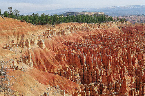
Pink Cliffs
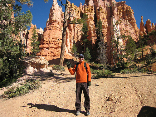
The Pink Cliffs are a series of highly-dissected cliffs, approximately 35 mi (56 km) long, along the southeast edge of the Paunsaugunt Plateau in southwestern Utah in the United States. The cliffs form unique rock formations and are largely protected as part of Bryce Canyon National Park. Geologically the cliffs are pink- and red-colored Claron Formation limestones, forming the upper riser of the Grand Staircase which descends southward to the Grand Canyon in Arizona.
Located at 37.52 -112.26 (Lat./Long.); Less than 20 km away
Pictures


Related Locations
Information of geographic nature is based on public data provided by geonames.org, CIA world facts book, Unesco, DBpedia and wikipedia. Weather is based on NOAA GFS.