-
You are here:
- Homepage »
- United States »
- Vermont » Londonderry

Londonderry Destination Guide
Explore Londonderry in United States
Londonderry in the region of Vermont is a place in United States - some 372 mi or ( 598 km ) North-East of Washington , the country's capital city .
Time in Londonderry is now 06:16 AM (Saturday) . The local timezone is named " America/New York " with a UTC offset of -4 hours. Depending on your budget, these more prominent locations might be interesting for you: Philadelphia, Boston, Concord, Newark, and Albany. Since you are here already, consider visiting Philadelphia . We saw some hobby film on the internet . Scroll down to see the most favourite one or select the video collection in the navigation. Where to go and what to see in Londonderry ? We have collected some references on our attractions page.
Videos
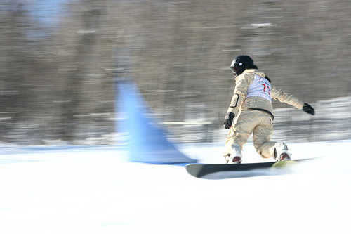
SNOWBOARDING FRENDS
Danny Davis talks about his frends - there is no I in Frends - who are all preparing for the Olympic halfpipe competition. Dawn Church was at the top of the pipe at the US Open when she spoke with Dan ..
More Snowboard Olympic Medals for the Americans?
The snowboard halfpipe is a glamor event of the Winter Olympics, attracting big crowds and lots of media attention. This is due, in large part, to American dominance of the event. With the whole world ..
Snow Report: January 14, 2012
2 powder days in one week? Sounds almost too good to be true, but here's the proof! 5"+ today, for a 2-day total of 12". Music: "The Pull" by BlueBrain freemusicarchive.org ..
Snow Report: January 1, 2012
Happy New Year from Stratton! ..
Videos provided by Youtube are under the copyright of their owners.
Interesting facts about this location
Ball Mountain Dam
Ball Mountain Dam (National ID # VT00001) is a dam in Jamaica, Windham County, Vermont, in the southeastern part of the state. The earthen and gravel gravity dam was constructed between 1957 and 1961 by the United States Army Corps of Engineers, with a height of 247 feet and a length of 915 feet at its crest. It impounds the West River of Vermont for flood control. The dams is owned and operated by the Corps of Engineers.
Located at 43.13 -72.77 (Lat./Long.); Less than 11 km away
West River (Vermont)
The West River is a tributary of the Connecticut River, about 53.8 miles long, in southern Vermont in the United States. According to the Geographic Names Information System, it has also been known historically as "Wantastiquet" and as "Waters of the Lonely Way". Its watershed covers 423 square miles; land use is about 90% forested and 3% agricultural, and the upper river supports wild brook trout and naturalized brown trout, while Atlantic salmon occur in most of the river.
Located at 43.33 -72.79 (Lat./Long.); Less than 12 km away
Griffith Lake
Griffith Lake is a small lake and campsite located in the towns of Peru and Mount Tabor, Vermont, in the Green Mountain National Forest. The site lies on the Long Trail/Appalachian Trail. The area is maintained by the Green Mountain Club and has an on-site caretaker to maintain the tent sites, outhouse, composting toilets, and trails during the peak season. During that time, there is a $5 charge for the overnight use of the tent platforms and nearby lean-to shelter.
Located at 43.30 -72.96 (Lat./Long.); Less than 15 km away
Stratton Mountain School
The Stratton Mountain School is a college preparatory high school located at Stratton Mountain in Stratton, Vermont. The school was founded in 1972 by Warren Hellman and Donald Tarinelli, and the current headmaster is Christopher Kaltas. Stratton Mountain School trains winter athletes with a focus on alpine skiing, snowboarding, and Nordic skiing. The school has produced 33 Olympic athletes who have won four medals (2 gold, 1 silver, and one bronze).
Located at 43.11 -72.89 (Lat./Long.); Less than 15 km away
Williams River (Vermont)
The Williams River is a 27.0-mile river in the U.S. state of Vermont. It is a tributary of the Connecticut River. Its watershed covers 117 square miles; land use is about 80% forested and 4% agricultural, and the upper river supports wild brook trout and brown trout. The Williams River rises in the northern part of the town of Andover and flows east through a corner of Ludlow and into Chester, where it turns south.
Located at 43.34 -72.67 (Lat./Long.); Less than 16 km away
Pictures
Related Locations
Information of geographic nature is based on public data provided by geonames.org, CIA world facts book, Unesco, DBpedia and wikipedia. Weather is based on NOAA GFS.