-
You are here:
- Homepage »
- Australia »
- Queensland » Howard

Howard Destination Guide
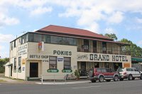
Explore Howard in Australia
Howard in the region of Queensland is a place in Australia - some 718 mi or ( 1156 km ) North of Canberra , the country's capital city .
Time in Howard is now 09:17 AM (Sunday) . The local timezone is named " Australia/Brisbane " with a UTC offset of 10 hours. Depending on your budget, these more prominent locations might be interesting for you: Traviston, Toogoom, Takura, Isis, and Buxton. Since you are here already, consider visiting Traviston . We saw some hobby film on the internet . Scroll down to see the most favourite one or select the video collection in the navigation. Where to go and what to see in Howard ? We have collected some references on our attractions page.
Videos
Home, house for sale Howard Queensland
The home and house at 47 Philip Street Howard is for sale. Located near Maryborough, Hervey Bay, Burrum Heads, and Childers, Horward is a traditional country town with good amenity. www.homeqld.com fo ..
CQ Flooding
Water over the road between Childers & Maryborough. ..
drank in my cup cover by slut_city_hacker !!!!!!!!!!![-]
..
it girl cover by slutcityhax
add me on skype slut_city_hax tell me song and i shal sing it ..
Videos provided by Youtube are under the copyright of their owners.
Interesting facts about this location
Howard railway station
Howard is a railway station on the North Coast railway line, Queensland. It is serviced twice daily by the Tilt Train. The railway station opened in 1883 to service the nearby colliery.
Located at -25.32 152.56 (Lat./Long.); Less than 0 km away
Howard, Queensland
Howard is a small town in Queensland, Australia, located 284 km north of Brisbane and 37 km west of Hervey Bay. At the 2006 census, Howard had a population of 1,071. The Bruce Highway passes through the edge of the town and Queensland's main north-south rail line cuts through its centre. The main streets of Howard are Steley and William. Steley Street contains the Skatepark, Railway Station, Children's playground, Community Centre, Kindergarten, Respite Centre, located on the southern end.
Located at -25.32 152.57 (Lat./Long.); Less than 1 km away
Torbanlea railway station
Torbanlea Railway Station is a closed railway station on the North Coast railway line in Queensland.
Located at -25.35 152.60 (Lat./Long.); Less than 5 km away
Lenthalls Dam
Lake Lenthall was named after the pioneering family in the district, the waters created by the dam are called Lake Lenthall. It was constructed in 1984 on the head waters of the Burrum River which also includes the Isis River, Cherwell River & Gregory Rivers in its 935 square kilometre catchment. As a result of a huge catchment it takes a short time in moderate rain events to fill Lake Lenthall to 100% capacity.
Located at -25.40 152.53 (Lat./Long.); Less than 10 km away
Colton railway station
Colton railway station is a closed railway station on the North Coast railway line in Queensland. It was the junction for the (now closed) Urangan railway line that extended from Colton to Takura, Stockyard Creek, Walligan, Nikenbah, Urraween, Kawungan, Pialba, Scarness, Torquay and finally Urangan and the Urangan Pier in Hervey Bay. Much of the Urangan line has now been removed, as has Colton station itself.
Located at -25.43 152.65 (Lat./Long.); Less than 15 km away
Pictures
Historical Weather
Related Locations
Information of geographic nature is based on public data provided by geonames.org, CIA world facts book, Unesco, DBpedia and wikipedia. Weather is based on NOAA GFS.

