-
You are here:
- Homepage »
- Australia »
- South Australia » Strathalbyn

Strathalbyn Destination Guide
Discover Strathalbyn in Australia
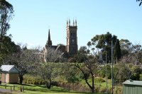
Strathalbyn in the region of South Australia with its 4,731 habitants is a town located in Australia - some 577 mi or ( 929 km ) West of Canberra , the country's capital .
Local time in Strathalbyn is now 10:55 PM (Thursday) . The local timezone is named " Australia/Adelaide " with a UTC offset of 10.5 hours. Depending on your flexibility, these larger cities might be interesting for you: Red Creek, Paris Creek, Milang, Meadows, and Macclesfield. When in this area, you might want to check out Red Creek . We found some clip posted online . Scroll down to see the most favourite one or select the video collection in the navigation. Are you looking for some initial hints on what might be interesting in Strathalbyn ? We have collected some references on our attractions page.
Videos
South Coast Helicopters - Fleurieu Peninsula Region
Vision of the beautiful Fleurieu Peninsula in South Australia, from South Coast Helicopters of Adelaide. ..
Strathalbyn Antique Fair
Annual Strathalbyn Collectors, Hobbies and Antiques Fair, 3rd weekend each August ..
Port Adelaide Caledonian Society_Garrick Stewart School of Highland Dancing.
The Garrick Stewart School of Highland Dancing, Including members of the Port Adelaide class, provided a display at the Strathalbyn Caledonian Society's Ceilidh, 16/4/2011 ..
Le Fleurieu: The Fleurieu Way (Fleurieu Peninsula)
Ron Kandelaars gives an introduction to the Fleurieu Peninsula and the best way to get around this beautiful region - with the Fleurieu Way! ..
Videos provided by Youtube are under the copyright of their owners.
Interesting facts about this location
Strathalbyn, South Australia
Strathalbyn is a town in South Australia, in the Alexandrina Council. The town has a population of 3894 people.
Located at -35.27 138.90 (Lat./Long.); Less than 1 km away
Ashbourne, South Australia
Ashbourne is a small town in South Australia situated approximately 14 kilometres from the town of Strathalbyn. At the 2006 census, Ashbourne had a population of 310.
Located at -35.28 138.77 (Lat./Long.); Less than 11 km away
Macclesfield, South Australia
Macclesfield is a small town on the upper reaches of the River Angas in the Adelaide Hills region of South Australia. At the 2006 census, Macclesfield had a population of 832. Macclesfield is in the District Council of Mount Barker local government area, the state electorate of Heysen and the federal Division of Mayo.
Located at -35.17 138.83 (Lat./Long.); Less than 12 km away
Nurragi railway station
Nurragi was a former railway siding in South Australia, located approximately halfway along the Sandergrove to Milang spur-line, which branched off from the Mount Barker-Victor Harbor railway line. Opened in 1884, it was a 70 metres-long goods siding. The siding was closed in 1970, when the spur-line was abandoned and removed when the track was dismantled in the 1970s.
Located at -35.37 138.91 (Lat./Long.); Less than 12 km away
McLaren Flat, South Australia
McLaren Flat is a township in the McLaren Vale/Willunga basin south of Adelaide. McLaren Flat is on the sprawling flat land to the east of the town of McLaren Vale on the road to Kangarilla. At the 2006 census, McLaren Flat had a population of 642. McLaren Flat is part of the McLaren Vale wine region. The area surrounding the town is planted to vineyards and several wineries are located in the immediate area. It has a population of 600.
Located at -35.35 138.98 (Lat./Long.); Less than 13 km away
Pictures
Historical Weather
Related Locations
Information of geographic nature is based on public data provided by geonames.org, CIA world facts book, Unesco, DBpedia and wikipedia. Weather is based on NOAA GFS.

