-
You are here:
- Homepage »
- Australia »
- Western Australia » Osborne Park

Osborne Park Destination Guide
Delve into Osborne Park in Australia
Osborne Park in the region of Western Australia with its 3,109 residents is a city in Australia - some 1,923 mi or ( 3094 km ) West of Canberra , the country's capital .
Current time in Osborne Park is now 12:46 PM (Sunday) . The local timezone is named " Australia/Perth " with a UTC offset of 8 hours. Depending on your travel modalities, these larger destinations might be interesting for you: Wembley, Wanneroo, Subiaco, Perth South, and Scarborough. While being here, make sure to check out Wembley . We encountered some video on the web . Scroll down to see the most favourite one or select the video collection in the navigation. Are you curious about the possible sightseeing spots and facts in Osborne Park ? We have collected some references on our attractions page.
Videos
Blake and Logan, our twins born at 26 weeks
This is the journey of our twins from the 12th week of pregnancy to 9 months old. They were born prematurely at 26 weeks gestation and spent months in the NICU. They amazed us along the way and are no ..
perth hail storm 22/03/10 3:50pm
very powerful storm just happened hail that was as big as golf balls you can hear smashing off the roof of my padio this was taken around ocean reef ..
Herdsman Lake
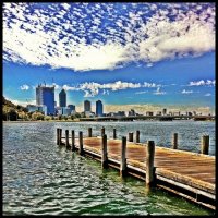
Perth view accross Herdsman Lake to Perth CBD and Subiaco football oval ..
A Bridge Swing Australia CROUCH
Crouch doing the 1st known bridge swing in perth;Crouch & Justins ROAD TRIP.Thought i was guna hit rocks,missed by 3ft with legs lifted ..
Videos provided by Youtube are under the copyright of their owners.
Interesting facts about this location
Osborne Park, Western Australia
Osborne Park is a suburb of Perth, Western Australia in the local government area of the City of Stirling. Osborne Park was named after William Osborne, a butcher who owned an abattoirs on Wanneroo Road and was elected to the Perth Road Board (the City of Stirling's predecessor), in 1875. The suburb was originally market gardens, due to rich peaty soil from the swamps between Lake Monger and Herdsman Lake. The area was popular among Chinese and Italian settlers.
Located at -31.90 115.81 (Lat./Long.); Less than 0 km away
City of Stirling
The City of Stirling is a local government area in the northern suburbs of the Western Australian capital city of Perth, located about 10 kilometres north of Perth's central business district. The City covers an area of 105.2 square kilometres and had a population of 205,960 in 2011, making it the largest local government area by population in Western Australia.
Located at -31.88 115.81 (Lat./Long.); Less than 2 km away
Innaloo, Western Australia
Innaloo is a suburb of Perth, the capital city of Western Australia, and it is located 9 km from Perth's central business district. Its Local Government Area is the City of Stirling. Innaloo is a more established residential suburb that is also home to the Westfield Innaloo and Westfield Innaloo Megacentre shopping centres, and is adjacent to Perth's largest cinema complex, the 18-cinema Greater Union Megaplex Innaloo.
Located at -31.89 115.79 (Lat./Long.); Less than 2 km away
Woodlands, Western Australia
Woodlands is a suburb of Perth, Western Australia. Its Local Government Area is the City of Stirling and it is in the federal Division of Curtin. Many of the streets in Woodlands are named after trees, such as oak, elm, birch, sandalwood and willow.
Located at -31.91 115.79 (Lat./Long.); Less than 2 km away
Tuart Hill, Western Australia
Tuart Hill is a suburb of Perth, Western Australia. Tuart Hill is named after the Tuart tree (Eucalyptus gomphocephala) that once grew extensively throughout the area, especially around Dog Swamp. In 1914 the suburb name of Grenville was proposed as a name for the suburb by the Grenville Progress Association, but not accepted due to its likeness to Granville in New South Wales.
Located at -31.90 115.83 (Lat./Long.); Less than 2 km away
Pictures
Historical Weather
Related Locations
Information of geographic nature is based on public data provided by geonames.org, CIA world facts book, Unesco, DBpedia and wikipedia. Weather is based on NOAA GFS.


