-
You are here:
- Homepage »
- Belgium »
- Walloon Region » Xhoris

Xhoris Destination Guide
Discover Xhoris in Belgium
Xhoris in the region of Walloon Region is a town located in Belgium - some 62 mi or ( 99 km ) South-East of Brussels , the country's capital .
Local time in Xhoris is now 07:29 AM (Friday) . The local timezone is named " Europe/Brussels " with a UTC offset of 1 hours. Depending on your flexibility, these larger cities might be interesting for you: The Hague, Haarlem, Amsterdam, Seraing, and Rixhalle. When in this area, you might want to check out The Hague . We found some clip posted online . Scroll down to see the most favourite one or select the video collection in the navigation. Are you looking for some initial hints on what might be interesting in Xhoris ? We have collected some references on our attractions page.
Videos
The Coaching Academy - Inge Rock
Wat zou je ervan vinden indien 6 dagen intensieve training, je hele leven verandert? How would you think and feel if 6 days could literaly change your life? Dit kan tijdens deze transformatieweek. Thi ..
Chalet Betula Alba
Chalet in de Ardennen. ..
Carriënta Outdoordome
Outdoor in de Ardennen begint pas echt als je de 450 meter lange tunnel die toegang biedt tot Carriënta bent doorgekomen. ..
De Ourthe bij Hamoir 20-07-2010
Trip door de Ardennen ..
Videos provided by Youtube are under the copyright of their owners.
Interesting facts about this location
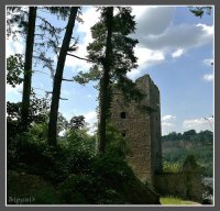
Fanson Castle
Fanson Castle (French: Château de Fanson) is a castle in the village of Xhoris in Ferrières, province of Liège, Belgium.
Located at 50.45 5.62 (Lat./Long.); Less than 1 km away
Rouvreux
Rouvreux is part of the Walloon commune of Sprimont in the province of Liège in Belgium. It is named after the hamlet at its centre. It was a commune of its own from its creation on 21 May 1886 (by the merger of parts of the communes of Aywaille and Sprimont) until the merger of communes in 1977.
Located at 50.49 5.65 (Lat./Long.); Less than 6 km away
Lassus Castle
Lassus Castle (French: Château de Lassus, or Hamoir-Lassus) is a château in Hamoir in the province of Liège, Belgium. The château, which stands on the banks of the Ourthe, was formerly the residence of the hereditary mayors of the village. The oldest part is a small donjon of the early 14th century. Long the property of the de Maillen family, the buildings were entirely remodelled in the 18th century in the Louis XIVth style.
Located at 50.42 5.52 (Lat./Long.); Less than 7 km away
Côte de La Redoute
The Côte de La Redoute is part of the Liège-Bastogne-Liège cycle route. It is located in the municipality of Aywaille and its incline is 2.3 km at 7.4%. It is named after a redoubt in the battle of Sprimont, which occurred at the village of Fontin, which is located on it, in the commune of Esneux. It also runs along an access route to autoroute E25 level with the village of Remouchamps. The region is the birthplace of the cyclist Philippe Gilbert.
Located at 50.49 5.71 (Lat./Long.); Less than 9 km away
Battle of Sprimont
The battle of Sprimont, battle of Esneux or battle of the Ourthe was a battle between French Republican and Austrian troops on the plateau between the valleys of the Vesdre, the Ourthe and the Amblève, 20 km to the south of Liège. It occurred on 17 and 18 September 1794 and was a French Republican victory put a final end to the Ancien Régime in what is now Belgium. The French troops dislodged Austrian troops occupying the plateau, though the French suffered heavy losses.
Located at 50.49 5.70 (Lat./Long.); Less than 9 km away
Pictures
Historical Weather
Related Locations
Information of geographic nature is based on public data provided by geonames.org, CIA world facts book, Unesco, DBpedia and wikipedia. Weather is based on NOAA GFS.

