-
You are here:
- Homepage »
- Canada »
- British Columbia » Hope

Hope Destination Guide
Delve into Hope in Canada
Hope in the region of British Columbia with its 4,598 residents is located in Canada - some 2,124 mi or ( 3418 km ) West of Ottawa , the country's capital .
Local time in Hope is now 05:02 AM (Saturday) . The local timezone is named " America/Vancouver " with a UTC offset of -7 hours. Depending on your mobility, these larger destinations might be interesting for you: Hillsboro, Portland, Bellingham, Coupeville, and Everett. While being here, you might want to check out Hillsboro . We discovered some clip posted online . Scroll down to see the most favourite one or select the video collection in the navigation. Are you curious about the possible sightseeing spots and facts in Hope ? We have collected some references on our attractions page.
Videos
BC Buggy - Caroline Mines Tour
BC Buggy Mountain Tours in Hope BC, Canada www.bcbuggy.com ..
Scenes of Hope BC
Hope BC is located on the Fraser river in a scenic mountain setting. Scene 1 - view from Hope Lookout Scene 2 - bear carving downtown Scene 3 - Hope District Hall Scene 4 - Clock at 3rd and Wallace Sc ..
BC Buggy - American Creek Run
BC Buggy Mountain Tours in Hope BC, Canada www.bcbuggy.com ..
Rally X Mitsubishi Ralliart - XRoss Motorsports
WCRC RallyX Mitsubishi Ralliart in the city of Hope, BC ..
Videos provided by Youtube are under the copyright of their owners.
Interesting facts about this location
Hope, British Columbia
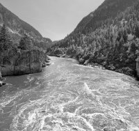
Hope is a district municipality located at the confluence of the Fraser and Coquihalla rivers in the province of British Columbia, Canada. Hope is at the eastern end of both the Fraser Valley and the Lower Mainland region, and is at the southern end of the Fraser Canyon. To the east over the Cascade Mountains is the Interior region, beginning with the Similkameen Country on the farther side of the Allison Pass in Manning Park.
Located at 49.39 -121.44 (Lat./Long.); Less than 0 km away
Haig, British Columbia
Haig is a settlement in British Columbia.
Located at 49.40 -121.46 (Lat./Long.); Less than 2 km away
Coquihalla River
The Coquihalla River is located in the Cascade Mountains near the town of Hope, British Columbia. It originates in the Coquihalla Lakes and empties into the Fraser River at Hope. The Coquihalla River divides two portions of the Cascades, the Skagit Range and the Hozameen Range. The river flows through a deep, narrow valley, dropping 3,400 feet in 33 miles, a tumultuous course that creates an incessant roar.
Located at 49.40 -121.43 (Lat./Long.); Less than 2 km away
Kawkawa Lake
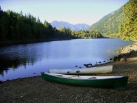
Kawkawa Lake is a lake located 2.5 km east of Hope, British Columbia. Kawkawa is also the name for the neighbourhood in Hope surrounding Kawkawa Lake. The lake is home to many species of fish, but it is best known for its large kokanee (land-locked salmon), which can reach up to 3+ lbs in weight. Kawkawa Lake Park is situated on the lake and has amenities such as: toilets, swimming beach, grassy play area, park benches with picnic tables and a small dock that has a concrete boat launch.
Located at 49.38 -121.40 (Lat./Long.); Less than 3 km away
Hope Mountain
Hope Mountain, 1844m, commonly called Mount Hope, is a prominent mountain overlooking the town of Hope, British Columbia, Canada from the south. It is the northernmost summit of the Skagit Range of the Cascade Mountains and stands above the confluence of the Coquihalla and Fraser Rivers. Hope Mountain dominates the view of southbound travellers in the lower Fraser Canyon between Yale and Hope.
Located at 49.35 -121.42 (Lat./Long.); Less than 4 km away
Pictures
Related Locations
Information of geographic nature is based on public data provided by geonames.org, CIA world facts book, Unesco, DBpedia and wikipedia. Weather is based on NOAA GFS.

