-
You are here:
- Homepage »
- Croatia »
- Splitsko-Dalmatinska » Zagvozd

Zagvozd Destination Guide
Explore Zagvozd in Croatia
Zagvozd in the region of Splitsko-Dalmatinska with its 970 inhabitants is a town in Croatia - some 175 mi or ( 282 km ) South of Zagreb , the country's capital city .
Current time in Zagvozd is now 10:39 PM (Saturday) . The local timezone is named " Europe/Zagreb " with a UTC offset of 1 hours. Depending on the availability of means of transportation, these more prominent locations might be interesting for you: Belgrade, Foggia, Bari, Zadar, and Vukovar. Since you are here already, make sure to check out Belgrade . We saw some video on the web . Scroll down to see the most favourite one or select the video collection in the navigation. Where to go and what to see in Zagvozd ? We have collected some references on our attractions page.
Videos
1986 Radio Zagreb Ekonomski program (ex) Jugoslavija
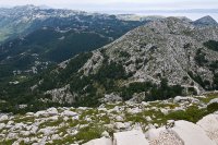
Wonderfull landscapes of the southern part of the Damatian region with the citys of Split and Omis , and then the massive moutains of Biokovo of wich Sv. Jure is the highest with its 1762 metres above ..
Zagvozd-Imotski
Kroz Zagvozd za Uskrs 2010. ..
A Frustrating, Confusing Bus Ride to Split, Croatia
www.TravelsWithSheila.com If it hadn't been for our Explore driver accompanying us to the bus terminal in Mostar, ex-Marine and I would still be wandering in a daze trying to get to Split. Such a conf ..
Trip to sv.Jura - Croatia
cesta autem na horu SV. Jura ..
Videos provided by Youtube are under the copyright of their owners.
Interesting facts about this location
Amfora Pit
Amfora is a pit on Biokovo Mountain, in Nature Park Biokovo. The entry to the cave is in the upper parts of the mountain, cca 1000 meters from Sv. Jure peak, on the southeast slope of one of many pits of Biokovo. It has been discovered in 1998, by speleo-alpine club Ekstrem (Makarska). Cavers from SAK Ekstrem, SO Velebit, SO Željezničar, SO Dubovac, SD Matokit, SD Krstatice made a first mini-expedition in the pit Amfora between 13. and 15. of October 2000.
Located at 43.35 17.05 (Lat./Long.); Less than 6 km away
Biokovo
Biokovo is the second-highest mountain range in Croatia, located along the Dalmatian coast of the Adriatic Sea, between the rivers of Cetina and Neretva. Its highest peak is Sveti Jure (Saint George), at 1762 m.a.s.l. The 196 km² of its area is protected as a nature park. It is sometimes referenced to as Bijakova, especially among inhabitants of the eastern side of the mountain.
Located at 43.33 17.05 (Lat./Long.); Less than 7 km away
Žeževica
Žeževica is a village in central Dalmatia, Croatia with a population of 337 (2011). It is located in the municipality of Šestanovac, 15 km from the Adriatic Sea. The community has a Mediterranean climate, and the streets are lined with stone houses and historic structures. The village's main landmark is the Church of St. George, built in 1776, which is located on a natural landmark, a hill named Orje. Žeževica is situated at the base of the Biokovo mountain.
Located at 43.45 16.97 (Lat./Long.); Less than 9 km away
Baška Voda
Baška Voda, is a municipality in Croatia in the Split-Dalmatia County. It has a population of 2,924 (2001 census), 95.5% which are Croats. It is located on the Adriatic coastline of Dalmatia 10 km northwest of Makarska. In ancient times, the little village of Bast nestled by a freshwater spring which supplied the Biokovo area. During the 18th century, after the expulsion of the Turks, its inhabitant left the slopes of St.
Located at 43.36 16.95 (Lat./Long.); Less than 10 km away
Podbablje
Podbablje is a municipality in Croatia in the Split-Dalmatia County. It has a population of 4,904 (2001 census), 93.6% which are Croats.
Located at 43.42 17.18 (Lat./Long.); Less than 10 km away
Pictures
Historical Weather
Related Locations
Information of geographic nature is based on public data provided by geonames.org, CIA world facts book, Unesco, DBpedia and wikipedia. Weather is based on NOAA GFS.


