
Explore Berrien in France
Berrien in the region of Bretagne with its 1,012 inhabitants is a town in France - some 280 mi or ( 451 km ) West of Paris , the country's capital city .
Current time in Berrien is now 12:26 AM (Saturday) . The local timezone is named " Europe/Paris " with a UTC offset of 1 hours. Depending on the availability of means of transportation, these more prominent locations might be interesting for you: Oxford, London, Cambridge, Bristol, and Vannes. Since you are here already, make sure to check out Oxford . We saw some video on the web . Scroll down to see the most favourite one or select the video collection in the navigation. Where to go and what to see in Berrien ? We have collected some references on our attractions page.
Videos
La Bretagne en camping car
Le Cotentin - La Bretagne en Camping car ..
Huelgoat centre bretagne hiver février 2011
Huelgoat Finistère centre bretagne hiver février 2011 ..
Driving Along Rue des Cieux & Place Aristide Briand D14, Huelgoat, Brittany 12th April 2010
Driving along Rue des Cieux & Place Aristide Briand (D14), Huelgoat, Finistere, Brittany, France Videoed on Monday,12th April 2010 Playlist: www.youtube.com ..
The River Ellez cascading the rocks at St. Herbot; Finistere; Breizh/Llydaw/Brittany/Bretagne
The River Ellez descends the rocks in a cascade from a hidden lake high up in the woods, to flow under the road below the chapel of St. Herbot on its way past Plouye to the Aulne in central Finistere, ..
Videos provided by Youtube are under the copyright of their owners.
Interesting facts about this location
Roc'h Trevezel
Roc'h Trevezel is the second peak of the Breton part of the Armorican Massif in the Monts d'Arrée. Just like the Signal of Toussaines, it reaches 384m in altitude. It is located in the commune of Plounéour-Ménez, near Roc'h Ruz, the highest point of the Monts d'Arrée in Brittany. Roc'h Trevezel is the highest peak on the Paris–Brest–Paris bicycle route.
Located at 48.41 -3.91 (Lat./Long.); Less than 11 km away
Réservoir Saint-Michel
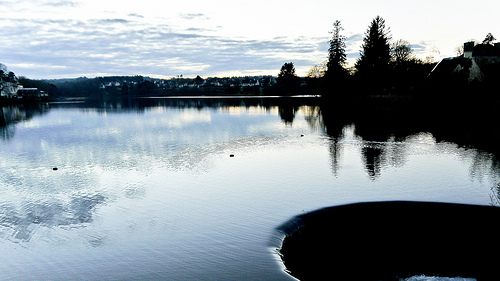
Réservoir Saint-Michel is a lake in Finistère, France. At an elevation of 227 m, its surface area is 4.5 km².
Located at 48.35 -3.90 (Lat./Long.); Less than 12 km away
Gare de Carhaix
Gare de Carhaix is a railway station serving the town Carhaix-Plouguer, Finistère department, western France. The station was the hub of the Réseau Breton.
Located at 48.28 -3.56 (Lat./Long.); Less than 20 km away
Parc botanique de Suscinio
The Parc botanique de Suscinio (28,862 m²) is a botanical garden located on the grounds of the Château de Suscinio, Morlaix, Finistère, in Brittany, north-west France. It is open daily; an admission fee is charged. The château dates to the 11th-15th centuries; note that it is distinct from the better-known Château de Suscinio in Morbihan. Its botanical park was created in 2004 as an ambitious development project supported by Morlaix, but then closed for several years before reopening in 2008.
Located at 48.58 -3.83 (Lat./Long.); Less than 20 km away
Gare de Morlaix
Gare de Morlaix is a railway station serving the town Morlaix, Finistère department, western France. It is situated on the Paris–Brest railway and the branch to Roscoff.
Located at 48.58 -3.83 (Lat./Long.); Less than 20 km away
Pictures

Related Locations
Information of geographic nature is based on public data provided by geonames.org, CIA world facts book, Unesco, DBpedia and wikipedia. Weather is based on NOAA GFS.