
Delve into Brusvily in France
Brusvily in the region of Bretagne with its 831 residents is a city in France - some 207 mi or ( 333 km ) West of Paris , the country's capital .
Current time in Brusvily is now 10:44 AM (Sunday) . The local timezone is named " Europe/Paris " with a UTC offset of 1 hours. Depending on your travel modalities, these larger destinations might be interesting for you: Oxford, London, Cambridge, Bristol, and Vannes. While being here, make sure to check out Oxford . We encountered some video on the web . Scroll down to see the most favourite one or select the video collection in the navigation. Are you curious about the possible sightseeing spots and facts in Brusvily ? We have collected some references on our attractions page.
Videos
Food in France
During our trip to Rennes we ate at various places. This is some of the images where food is involved. ..
Maurice in France
CAA suspension means a foreign licence needed for French registered J3 L4 1943 Piper Cub almost ready to circumnavigate Africa ..
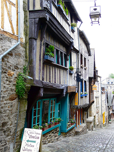
Dinan By Night, Christmas lights 2008
Traversée de Dinan (22) illuminée pour les fêtes de fin d'année. Décembre 2008. ..
Dinan Fête des Remparts
défilé ..
Videos provided by Youtube are under the copyright of their owners.
Interesting facts about this location
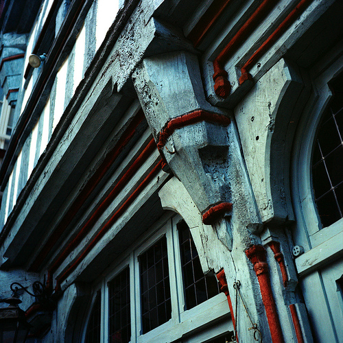
Château de Dinan
The Château de Dinan consists of a keep, in the town of Dinan, in the Côtes-d'Armor département of the Brittany region of France. The keep and the gate are part of the 2,600 metres of medieval ramparts which still surround the old town. It is called Donjon de la duchesse Anne (Keep of the Duchess Anne), and stands 111 feet (34m) high near the Saint Louis gate. John V, Duke of Brittany built the keep in 1382-1383.
Located at 48.45 -2.04 (Lat./Long.); Less than 9 km away
Plouër-sur-Rance
Plouër-sur-Rance is a commune in the Côtes-d'Armor department of Brittany in north-western France. Over twenty years, René-Thierry Magon de la Villehuchet was renovating and organizing the archives of Le Château de Plouër, which he'd inherited from an uncle, and was nearly finished with the endeavor at the time of his death in 2008.
Located at 48.52 -2.01 (Lat./Long.); Less than 17 km away
The Singing Stones of Brittany
The 'Pierre Sonnantes' or Singing Stones of Brittany are located on the left bank of the river L'Arguenon opposite the ruined castle of Gilles de Bretagne at Notre-Dame-le-Guildo, near Dinard in the Cotes D'Armor. The stones are round and smooth, shiny black and extremely large, weighing in excess of ten tonnes each and are made of a heavy metallic stone that rings like a bell if struck by another smaller piece of the same stone.
Located at 48.58 -2.21 (Lat./Long.); Less than 22 km away
Dinard–Pleurtuit–Saint-Malo Airport
Dinard–Pleurtuit–Saint-Malo Airport or Aéroport de Dinard - Pleurtuit - Saint-Malo is an airport serving the city of Saint-Malo, France. It is located 5 km south-southwest of Dinard in Pleurtuit, a commune of the département of Ille-et-Vilaine.
Located at 48.59 -2.08 (Lat./Long.); Less than 22 km away
Abbey of St Meen
The Abbey of Saint Meen (French: Abbaye Saint-Jean de Gaël and later Abbaye de Saint-Méen) is an abbey in Saint-Méen-le-Grand in Brittany. It was founded in the 6th century by Saint Meven (Méen), after whom it was eventually named. The original foundation had fallen into disuse by the end of the eighth century. Hélocar, bishop of Alet, refounded it in 818. It was destroyed by Vikings in 919. About a century later, it was reconstructed as a Benedictine monastery.
Located at 48.19 -2.19 (Lat./Long.); Less than 23 km away
Pictures
Related Locations
Information of geographic nature is based on public data provided by geonames.org, CIA world facts book, Unesco, DBpedia and wikipedia. Weather is based on NOAA GFS.