
Explore Loperhet in France
Loperhet in the region of Bretagne with its 3,524 inhabitants is a town in France - some 306 mi or ( 492 km ) West of Paris , the country's capital city .
Current time in Loperhet is now 12:11 PM (Monday) . The local timezone is named " Europe/Paris " with a UTC offset of 1 hours. Depending on the availability of means of transportation, these more prominent locations might be interesting for you: Oxford, Bristol, Rostiviec, Quimper, and Penhoat. Since you are here already, make sure to check out Oxford . We saw some video on the web . Scroll down to see the most favourite one or select the video collection in the navigation. Where to go and what to see in Loperhet ? We have collected some references on our attractions page.
Videos
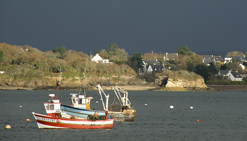
Port du Tinduff (rade de Brest) et ses 2 cales, 10 jan 2012
** Géolocalisation de cette vidéo sur Google Maps : goo.gl ** La vue sur Street view : goo.gl Port du Tinduff (Baie de Daoulas en Rade de Brest) et ses 2 cales, 10 jan 2012 - 17h00 Filmé avec une camé ..
Arbre de la Vie
Musique de Michel Pépé : le Berceau de la Vie, album Présence de l'Ange. Poème écrit au début de mon cheminement intérieur ..
Grande Marée au port du Tinduff
un jour de gros coefficient de marée sur le port du Tinduff Musique de Marijanh ..
En bateau
rade de brest ..
Videos provided by Youtube are under the copyright of their owners.
Interesting facts about this location
Pont de l'Iroise
The Pont de l'Iroise is a cable-stayed bridge in Finistère, Brittany, France, which spans the Élorn river where it enters the roadstead of Brest. It carries route nationale 165, the road between Brest and Quimper, and connects Le Relecq-Kerhuon to the north with Plougastel-Daoulas to the south. The bridge is named after the Iroise Sea, into which the roadstead of Brest opens.
Located at 48.39 -4.40 (Lat./Long.); Less than 7 km away
Plougastel Bridge
The Plougastel Bridge, or Albert-Louppe Bridge, is a bridge over the Elorn River near Brest, France, connecting Plougastel-Daoulas and Le Relecq-Kerhuon. Construction on the Plougastel Bridge started in 1926 and was completed on 9 October 1930. Part of it was destroyed by the German army in 1944, and shortly after was closed for repair. It was reopened after the widening and construction five years later.
Located at 48.39 -4.40 (Lat./Long.); Less than 7 km away
Élorn
The Élorn (in Breton - Elorn, without the accent) is a 56 km long river in Brittany, France. Its source is in the monts d'Arrée, 1.5km NNE of Le Tuchenn Kador, and it then runs through several small towns such as Sizun and Landivisiau before flowing out into the roadstead of Brest. This river is the birhplace of the legendary Dragon of the Élorn. The maritime part of the river stops at Landerneau, where the pont de Rohan blocks seaborne ships from sailing any further upstream.
Located at 48.38 -4.41 (Lat./Long.); Less than 8 km away
Aulne
The Aulne is a 140 km long river of Brittany in north-western France, flowing down the hills and emptying into the roadstead of Brest, one of the many fjord-like bays just south of Brest. The river is part of the Canal de Nantes à Brest, the navigation canal that once connected the city of Nantes on the Loire River with the port town of Brest on the Atlantic coast.
Located at 48.31 -4.33 (Lat./Long.); Less than 8 km away
Gare de Landerneau
Gare de Landerneau is a railway station serving the town Landerneau, Finistère department, western France. It is situated on the Paris–Brest railway and the branch to Quimper.
Located at 48.45 -4.26 (Lat./Long.); Less than 9 km away
Pictures
Related Locations
Information of geographic nature is based on public data provided by geonames.org, CIA world facts book, Unesco, DBpedia and wikipedia. Weather is based on NOAA GFS.