-
You are here:
- Homepage »
- France »
- Languedoc-Roussillon » Cornillon

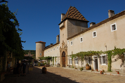
Cornillon Destination Guide
Discover Cornillon in France
Cornillon in the region of Languedoc-Roussillon with its 753 habitants is a town located in France - some 336 mi or ( 540 km ) South of Paris , the country's capital .
Local time in Cornillon is now 08:16 PM (Monday) . The local timezone is named " Europe/Paris " with a UTC offset of 1 hours. Depending on your flexibility, these larger cities might be interesting for you: Tresques, Saint-Paulet-de-Caisson, Saint-Nazaire, Saint-Étienne, and Pont-Saint-Esprit. When in this area, you might want to check out Tresques . We found some clip posted online . Scroll down to see the most favourite one or select the video collection in the navigation. Are you looking for some initial hints on what might be interesting in Cornillon ? We have collected some references on our attractions page.
Videos
La Cèze aux cascades du Sautadet le 31 octobre 2010 Mab9
Montée des eaux de la rivière la Cèze après 2 jours de pluie non-stop !!! En temps général, un petite rivière paisible ... ..
Doing Life on your days off
A short action packed adventure sport film, showcasing what staff get up to on their days off whilst working for NST Travel Group PLC at its French Activity centre - NST Lou Valagran ..
La Roque sur Ceze, France - Waterfall, Cascade. [Full HD]
La Roque sur Ceze - Waterfall, Cascade. Filmed with Canon 7D with 17-40L lens in 1080P. No video editing, RAW shoot. ..
La Roque sur Ceze, France - Waterfall, Cascade. [Full HD]
La Roque sur Ceze - Waterfall, Cascade. Filmed with Canon 7D with 17-40L lens in 1080P. No video editing, RAW shoot. ..
Videos provided by Youtube are under the copyright of their owners.
Interesting facts about this location
Château d'Aiguèze
Château d'Aiguèze is a château in Aiguèze, Gard, France. The castle was built on the top of a cliff over the Ardèche river.
Located at 44.30 4.56 (Lat./Long.); Less than 10 km away
Aven d'Orgnac
Aven d'Orgnac is a cave located near Orgnac-l'Aven, in the Ardèche département. Discovered in 1935 by Robert de Joly and open to the public since 1939, it is one of the most visited places in that area. Caves such as this are found in many Limestone areas, such as the White Scar Caves near Skipton in Yorkshire.
Located at 44.32 4.41 (Lat./Long.); Less than 13 km away
Aiguillon (Cèze)
The Aiguillon is a river in southern France, a tributary of the Cèze. It is the departments of Gard, in the Languedoc-Roussillon region. The source of the River Aiguillon is on Mont Bouquet, west of Lussan. It flows through Lussan, Les Concluses, Goussargues where it joined by the Merderis and it flows into the Cèze upstream of La Roque-sur-Cèze.
Located at 44.15 4.31 (Lat./Long.); Less than 16 km away
Pont d'Arc
The Pont d'Arc (French pont = bridge) is a large natural bridge, located in the Ardèche département in the south of France, 5 km from the town of Vallon-Pont-d'Arc. The arch, carved out by the Ardèche River, is 60 m wide and 54 m high. It is a very popular canoeing and kayaking area and is heavily visited by tourists. It is usually described as the natural entrance to the Ardèche Canyon.
Located at 44.38 4.42 (Lat./Long.); Less than 18 km away
Chauvet Cave
The Chauvet-Pont-d'Arc Cave in the Ardèche department of southern France is a cave that contains some of the earliest known cave paintings, as well as other evidence of Upper Paleolithic life. It is located near the commune of Vallon-Pont-d'Arc on a limestone cliff above the former bed of the Ardèche River. Discovered on December 18, 1994, it is considered one of the most significant prehistoric art sites.
Located at 44.39 4.41 (Lat./Long.); Less than 19 km away
Pictures
Historical Weather
Related Locations
Information of geographic nature is based on public data provided by geonames.org, CIA world facts book, Unesco, DBpedia and wikipedia. Weather is based on NOAA GFS.