-
You are here:
- Homepage »
- France »
- Languedoc-Roussillon » Creissan

Creissan Destination Guide
Touring Creissan in France
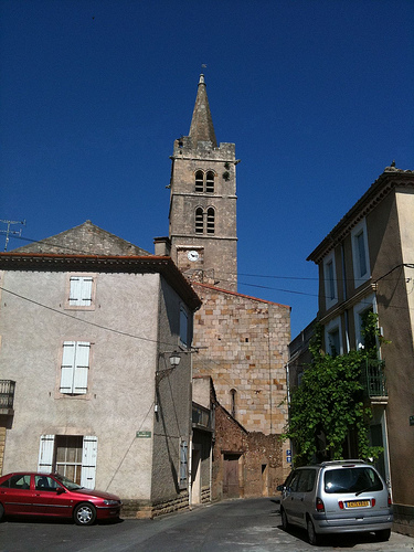
Creissan in the region of Languedoc-Roussillon with its 1,103 citizens is a city located in France - some 380 mi or ( 611 km ) South of Paris , the country's capital city .
Time in Creissan is now 12:11 PM (Saturday) . The local timezone is named " Europe/Paris " with a UTC offset of 1 hours. Depending on your travel resources, these more prominent places might be interesting for you: Villespassans, Thezan-les-Beziers, Rodez, Perpignan, and Ouveillan. Being here already, consider visiting Villespassans . We collected some hobby film on the internet . Scroll down to see the most favourite one or select the video collection in the navigation. Check out our recommendations for Creissan ? We have collected some references on our attractions page.
Videos
Canal du Midi cruise croisiere bateauxdumidi@gmail.com
Canal du Midi cruise croisiere three nights and four days onboard luxury hotel barge Clair de Lune ..
Young grape vines
Jérôme Roger, owner of the Château du Prieuré des Mourgues in the Languedoc-Roussillon region of France, discusses his young grape vines. ..
Tour de France Capestang 2008_1.wmv
A day at the tour in summer 2008, by the Canal de Midi outside Capestang ..
Languedoc - the Real South of France - DVD Video - Trailer
Languedoc - the Real South of France - DVD Video - Trailer. This, our first journey through the Languedoc begins at the Millau Bridge -- a spectacular construction regarded as the gateway to the regio ..
Videos provided by Youtube are under the copyright of their owners.
Interesting facts about this location
Oppidum d'Ensérune
The Oppidum d'Ensérune is an ancient hill-town near the village of Nissan-lez-Ensérune, France, located between Béziers and Narbonne close to the D609 and Canal du Midi. The settlement was occupied without interruption between the 6th century BC and 1st century AD, its location being chosen presumably because it was a hill with good views over the coastal plain, being close to the Roman road Via Domitia, the Montady lake, and fertile agricultural land below.
Located at 43.32 3.12 (Lat./Long.); Less than 11 km away
Pont Serme
The Pont Serme or Pons Selinus, later called the Pons Septimus, was a Roman bridge of the Via Domitia in Hérault, southern France. The approximately 1500 m long viaduct crossed the wide marshes of the Orb River and the Etang de Capestang west of Béziers, surpassing in terms of length even the Trajan's Bridge over the Danube. Today, very little traces are left at the site, save the name proper which passed over to a village nearby.
Located at 43.27 3.05 (Lat./Long.); Less than 12 km away
Malpas Tunnel
The Malpas tunnel was excavated in 1679 under the hill d'Ensérune in Hérault, allowing the passage of the Canal du Midi. It was Europe's first navigable canal tunnel and a monument to the determination of Pierre-Paul Riquet, the chief engineer. It is located in the commune of Nissan-lez-Ensérune. The Oppidum d'Ensérune is located on the surface a short distance from the tunnel. There was great disappointment when the works reached the hill d'Ensérune.
Located at 43.31 3.13 (Lat./Long.); Less than 12 km away
Port de la Robine
Port de la Robine is located at PK168 on the Canal du Midi immediately adjacent to the Truilhas Bridge. The turn for the La Nouvelle branch is .5 km north east and the Cesse aqueduct .5 km south west. There is room for 80 boats. Facilities include parking, sanitation, fuel, and security. Map
Located at 43.28 2.92 (Lat./Long.); Less than 13 km away
Cesse Aqueduct
Cesse Aqueduct (French: Pont-Canal de la Cesse) is one of several aqueducts, or water bridge, created for the Canal du Midi. Originally, the canal crossed the Cesse on the level. Pierre-Paul Riquet, the original architect of the canal, had placed a curved dam 205 metres long and 9.10 metres high across the Cesse in order to collect water to make the crossing possible; the aqueduct replaced this dam.
Located at 43.28 2.92 (Lat./Long.); Less than 13 km away
Pictures
Historical Weather
Related Locations
Information of geographic nature is based on public data provided by geonames.org, CIA world facts book, Unesco, DBpedia and wikipedia. Weather is based on NOAA GFS.