-
You are here:
- Homepage »
- France »
- Midi-Pyrenees » Montferrier

Montferrier Destination Guide
Delve into Montferrier in France
Montferrier in the region of Midi-Pyrénées with its 704 residents is located in France - some 413 mi or ( 664 km ) South of Paris , the country's capital .
Local time in Montferrier is now 04:57 PM (Thursday) . The local timezone is named " Europe/Paris " with a UTC offset of 1 hours. Depending on your mobility, these larger destinations might be interesting for you: Villeneuve-d'Olmes, Varilhes, Toulouse, Sautel, and Saint-Paul-de-Jarrat. While being here, you might want to check out Villeneuve-d'Olmes . We discovered some clip posted online . Scroll down to see the most favourite one or select the video collection in the navigation. Are you curious about the possible sightseeing spots and facts in Montferrier ? We have collected some references on our attractions page.
Videos
Moto.Pyrenees
Moto in de Pyreneeën / Moto dans les Pyrénées Voor meer info / Pour plus d'info : www.moto-pyrenees.com ..
Pic st Barthélemy et les étangs Diable et Truites.
dahu-ariege.monsite-orange.fr Le pic du saint Barthélemy est un aura solaire, vu imprenable sur les Pyrénnées. Boucles par les étang du Diable et Truites. Venez découvrir le Parc Naturel de L'Ariège ..
Inside Château de Montségur
The inner court-yeard of Château de Montségur. Midi-Pyrénées, Ariége in the the South of France ..
On the top of the walls of Château de Montségur
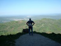
The view from the top of the walls of the Montsegur Fortress reaching dozens of miles in every direction. The view to the grand Pyrynees peaks still snow covered is really breathtaking. ..
Videos provided by Youtube are under the copyright of their owners.
Interesting facts about this location
Château de Montségur
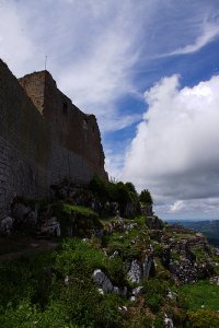
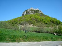
The Château de Montségur is a former fortress near Montségur, a commune in the Ariège department in southwestern France. Its ruins are the site of a razed stronghold of the Cathars. The present fortress on the site, though described as one of the "Cathar castles," is actually of a later period. It has been listed as a monument historique by the French Ministry of Culture since 1862.
Located at 42.88 1.83 (Lat./Long.); Less than 4 km away
Château de Roquefixade
The Château de Roquefixade is a ruined castle built on a cliff overlooking the village of Roquefixade, situated 8km (5 miles) west of Lavelanet French département of Ariège. There are records of a castle on the site going back to 1180, though the present ruins are more modern. While marketed in the tourist industry as one of the so-called Cathar castles, the ruins are later than this. Despite this, the site did provide a place of refuge for the Cathars at the time of the Albigensian Crusade.
Located at 42.94 1.75 (Lat./Long.); Less than 6 km away
Gare de Saint-Paul-Saint-Antoine
Saint-Paul-Saint-Antoine is a railway station in Saint-Paul-de-Jarrat, Midi-Pyrénées, France.
Located at 42.92 1.64 (Lat./Long.); Less than 12 km away
Château de Montaillou
The Château de Montaillou is a ruined castle in the French village of Montaillou, in the Ariège département. The village of Montaillou, standing on the slope of Mount Allion, was made famous in Emmanuel Le Roy Ladurie's history, Montaillou, village occitan. At the top of the village is all that remains of the rectangular castle: a ruined tower and evidence of walls and earthworks. The castle was built by the lords of Alion around the end of the 12th century.
Located at 42.79 1.89 (Lat./Long.); Less than 15 km away
Mancomunidad de la Comarca de Pamplona
The Mancomunidad de la Comarca de Pamplona is a community of municipalities of the Pamplona metropolitan area, whose functions are water supply and sewage treatment, waste management, metropolitan public transportation, taxi and the Arga metropolitan park. Historically, it was born as Mancomunidad de Aguas de la Comarca de Pamplona in 1982 in order to provide water services. It changed its name when the entity began to manage waste in 1987.
Located at 42.82 1.63 (Lat./Long.); Less than 15 km away
Pictures
Historical Weather
Related Locations
Information of geographic nature is based on public data provided by geonames.org, CIA world facts book, Unesco, DBpedia and wikipedia. Weather is based on NOAA GFS.


