-
You are here:
- Homepage »
- France »
- Provence-Alpes-Cote d'Azur » Cassis

Cassis Destination Guide
Discover Cassis in France
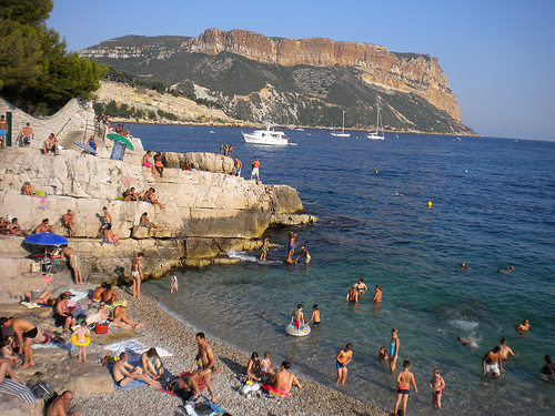
Cassis in the region of Provence-Alpes-Côte d'Azur with its 8,361 habitants is a town located in France - some 419 mi or ( 674 km ) South of Paris , the country's capital .
Local time in Cassis is now 08:15 PM (Monday) . The local timezone is named " Europe/Paris " with a UTC offset of 1 hours. Depending on your flexibility, these larger cities might be interesting for you: Toulon, Sainte-Croix, Plan-de-Cuques, Nîmes, and Marseille. When in this area, you might want to check out Toulon . We found some clip posted online . Scroll down to see the most favourite one or select the video collection in the navigation. Are you looking for some initial hints on what might be interesting in Cassis ? We have collected some references on our attractions page.
Videos
Cassis
A short clip showcasing Cassis, a small town near Marseille, southern France. Shot in winter to pretend it's summer:) Music by Rafał Wilk ..
Marseille-Cassis 20km 2011 Part2 Compétition Course à Pied Semi Marathon Running Race Vidéo
Edition 2012 ici : www.youtube.com 1ère partie ici : www.youtube.com 2ème partie Record battu par Atsedu Tsegay en 58mn10s ! Record féminin battu par Lydia Cheromei en 1h08 ! Keywords : course à pied ..
Marseille-Cassis 20km 2011 Part3 Compétition Course à Pied Semi Marathon Running Race Vidéo
3ème partie Record battu par Atsedu Tsegay en 58mn10s ! Record féminin battu par Lydia Cheromei en 1h08 ! Keywords : course à pied running coureurs épreuve podium vainqueur photos classique internatio ..
Village de Cassis, Video test avec PlaySport zx3 Kodak
Ma première video réalisée (test) à Cassis avec ma caméra "PlaySport" zx3 de Kodak, en 720p 30fps, fin décembre 2010. ..
Videos provided by Youtube are under the copyright of their owners.
Interesting facts about this location
Cap Canaille
Cap Canaille is a headland situated in the Bouches-du-Rhône département, in southern France, on the Mediterranean Sea coast between the towns Cassis and La Ciotat. At 394 m, it is the highest sea cliff of France. The rock face of Cap Canaille is called Falaises de Soubeyrannes. The rock consists of layers of ochre-coloured sandstone, conglomerate and limestone from the Turonian age on top of grey marl from the Cenomanian until the Turonian age.
Located at 43.19 5.55 (Lat./Long.); Less than 2 km away
Calanque de Port-Miou
The Calanque de Port-Miou is one of the three big Cassis calanques. It is very long and narrow, and thus was very suitable for establishing a marina.
Located at 43.21 5.52 (Lat./Long.); Less than 3 km away
Corniche des Crêtes
The Corniche des Crêtes is a picturesque and narrow coastal road in the south of France, winding from Cassis to La Ciotat along the Mediterranean shore. The road was opened to traffic in 1969 and it leads along the Falaises up to Cap Canaille, a cape 362 metres above the sea, and the highest cliff in France. From there it continues to Grande Tête, an elevation which is 399 metres high.
Located at 43.18 5.58 (Lat./Long.); Less than 4 km away
Canton of La Ciotat
The Canton of La Ciotat is a canton located within the Bouches-du-Rhône department of France. It was created 27 February 2003 by the decree 2003-156 of that date. Elected to represent the canton in the General Council of Bouches-du-Rhône : Patrick Boré
Located at 43.17 5.61 (Lat./Long.); Less than 7 km away
Parc du Mugel
The Parc du Mugel is a municipal park and botanical garden in the town of La Ciotat, in the French department of Bouches-du-Rhône, on the Mediterranean coast of France between Marseille and Toulon. It is listed among the Notable Gardens of France by the French Ministry of Culture.
Located at 43.16 5.61 (Lat./Long.); Less than 7 km away
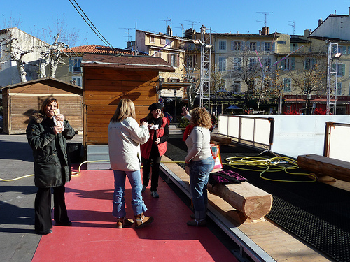
Pictures

Historical Weather
Related Locations
Information of geographic nature is based on public data provided by geonames.org, CIA world facts book, Unesco, DBpedia and wikipedia. Weather is based on NOAA GFS.