-
You are here:
- Homepage »
- France »
- Rhone-Alpes » La Coucourde

La Coucourde Destination Guide
Discover La Coucourde in France
La Coucourde in the region of Rhône-Alpes with its 795 habitants is a town located in France - some 312 mi or ( 503 km ) South of Paris , the country's capital .
Local time in La Coucourde is now 10:26 PM (Friday) . The local timezone is named " Europe/Paris " with a UTC offset of 1 hours. Depending on your flexibility, these larger cities might be interesting for you: Saint-Julien-en-Saint-Alban, Saint-Étienne, Rochemaure, Nîmes, and Montpellier. When in this area, you might want to check out Saint-Julien-en-Saint-Alban . We found some clip posted online . Scroll down to see the most favourite one or select the video collection in the navigation. Are you looking for some initial hints on what might be interesting in La Coucourde ? We have collected some references on our attractions page.
Videos
CS : Cheval nucléaire
A horse near the nuclear central of Cruas-Meysse, between Valence and Montelimar. Un cheval près de la centrale nucléaire de Cruas-Meysse, entre Valence et Montélimar. ..
Cruas
Brève visite de Cruas / Short visit of Cruas / Kurzbesuch Cruas (Ardèche France, 13 Avril 2008) fr.wikipedia.org www.cruas.com VALPARD FILMS valpardfilms.awardspace.com ..
Déchargement d'un Mirage 5 au Musée Européen de l'Aviation de Chasse
Déchargement d'un Mirage 5 au Musée Européen de l'Aviation de Chasse Vendredi 04 Juin 2010 - Ancône / Montelimar www.montelimar.net - http ..
le Merle Roux Ardèche 2010
onze vakantie in de Ardeche op camping Le Merle Roux ..
Videos provided by Youtube are under the copyright of their owners.
Interesting facts about this location
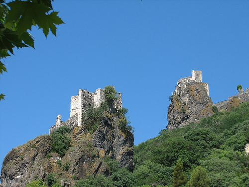
Château des Adhémar
The Château des Adhémar stands on a hill in the centre of the French town of Montélimar in the Drôme département.
Located at 44.56 4.75 (Lat./Long.); Less than 11 km away
Drôme (river)
The Drôme, a river in southeastern France, has a length of 110 km long and is a left tributary of the Rhône River. Its source is in the western foothills of the Alps, near the village Valdrôme. It flows into the Rhône near Loriol-sur-Drôme, between Valence and Montélimar. The Drôme flows through the following départements and towns: Drôme (named after the river): Valdrôme, Luc-en-Diois, Die, Saillans, Allex, Crest, Loriol-sur-Drôme, Livron-sur-Drôme Ardèche : Le Pouzin
Located at 44.77 4.76 (Lat./Long.); Less than 13 km away
Château de Grâne
The Château de Grâne is a ruined castle in the commune of Grâne in the Drôme département of France. The castle stands above the village of Grâne and is largely in ruins. Remains include sections of the curtain wall and a tower. The mounting for an old mullioned window and a spiral staircase are visible, as well as vaulted cellars from the 13th century.
Located at 44.73 4.92 (Lat./Long.); Less than 14 km away
Eyrieux (river)
The Eyrieux River is a tributary of the Rhône River in Europe. The Eyrieux runs for 83 kilometres . It begins in the Massif Central and joins the Rhône in the Rhône Valley just downstream of Valence. The Eyrieux has at least three distinct landscapes. Above Le Cheylard, the plateau is marked by the sugarloaf cones of old volcanoes, and the land is used mostly for raising cattle and sheep.
Located at 44.81 4.80 (Lat./Long.); Less than 17 km away
Siege of Privas
The Siege of Privas was undertaken by Louis XIII of France from 14 May 1629, and the city of Privas was captured on 28 May 1629. It was one of the last events of the Huguenot rebellions (1621-1629).
Located at 44.73 4.60 (Lat./Long.); Less than 17 km away
Pictures
Historical Weather
Related Locations
Information of geographic nature is based on public data provided by geonames.org, CIA world facts book, Unesco, DBpedia and wikipedia. Weather is based on NOAA GFS.