-
You are here:
- Homepage »
- France »
- Rhone-Alpes » Lyas

Lyas Destination Guide
Delve into Lyas in France
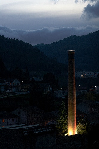
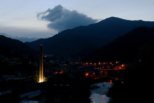
Lyas in the region of Rhône-Alpes with its 547 residents is a city in France - some 302 mi or ( 487 km ) South of Paris , the country's capital .
Current time in Lyas is now 09:26 AM (Friday) . The local timezone is named " Europe/Paris " with a UTC offset of 1 hours. Depending on your travel modalities, these larger destinations might be interesting for you: Vesseaux, Vernoux-en-Vivarais, Saint-Julien-en-Saint-Alban, Saint-Étienne, and Pranles. While being here, make sure to check out Vesseaux . We encountered some video on the web . Scroll down to see the most favourite one or select the video collection in the navigation. Are you curious about the possible sightseeing spots and facts in Lyas ? We have collected some references on our attractions page.
Videos
Le moulin de Mandy (Ardèche - France)
GPS: 44°46'10"N 4°35'10"E Map for tourists: maps.google.fr VALPARD FILMS valpardfilms.awardspace.com ..
voyage-en-ardeche
Voyage à travers l'ardèche, de Balazuc à Alissas en passant par saint vincent de Barres... ..
La Biquette de La Jaubernie (Coux - Ardèche - France)
www.leon.picodon-aoc.fr Tél +33475645598 Map for tourists: maps.google.fr VALPARD FILMS valpardfilms.awardspace.com ..
2007 - Camping Albanou in St. Julien-en-St-Alban Frankrijk
cp. Albanou in St. Julien-en-St-Alban/Ardeche in 2007. A vieuw over and pictures of the campsite and surroundings in the Ardeche Music by: Jan Akkerman ..
Videos provided by Youtube are under the copyright of their owners.
Interesting facts about this location
Siege of Privas
The Siege of Privas was undertaken by Louis XIII of France from 14 May 1629, and the city of Privas was captured on 28 May 1629. It was one of the last events of the Huguenot rebellions (1621-1629).
Located at 44.73 4.60 (Lat./Long.); Less than 2 km away
Maléon
Maléon is a hamlet in the outskirts of le Moulinon (a suburb of Saint-Sauveur-de-Montagut in the Ardèche département of France. The hamlet is affiliated to Saint-Sauveur-de-Montagut. The Auzène river flows up through the hamlet, and as a result it is possible to swim in the river underneath the bridge. There are a few families living in Maléon, although there are cottages often frequented by tourists in the summer months.
Located at 44.81 4.58 (Lat./Long.); Less than 6 km away
Drôme (river)
The Drôme, a river in southeastern France, has a length of 110 km long and is a left tributary of the Rhône River. Its source is in the western foothills of the Alps, near the village Valdrôme. It flows into the Rhône near Loriol-sur-Drôme, between Valence and Montélimar. The Drôme flows through the following départements and towns: Drôme (named after the river): Valdrôme, Luc-en-Diois, Die, Saillans, Allex, Crest, Loriol-sur-Drôme, Livron-sur-Drôme Ardèche : Le Pouzin
Located at 44.77 4.76 (Lat./Long.); Less than 13 km away
Eyrieux (river)
The Eyrieux River is a tributary of the Rhône River in Europe. The Eyrieux runs for 83 kilometres . It begins in the Massif Central and joins the Rhône in the Rhône Valley just downstream of Valence. The Eyrieux has at least three distinct landscapes. Above Le Cheylard, the plateau is marked by the sugarloaf cones of old volcanoes, and the land is used mostly for raising cattle and sheep.
Located at 44.81 4.80 (Lat./Long.); Less than 17 km away
Ibie
The Ibie is a 32.9 km long river in the Ardèche département, southeastern France. Its source is at Saint-Jean-le-Centenier, 2 km south of the village. It flows generally south-southwest, through the northern part of the Côtes du Vivarais AOC. It is a left tributary of the Ardèche into which it flows at Vallon-Pont-d'Arc, 1.8 km southeast of the village.
Located at 44.57 4.54 (Lat./Long.); Less than 21 km away
Pictures
Historical Weather
Related Locations
Information of geographic nature is based on public data provided by geonames.org, CIA world facts book, Unesco, DBpedia and wikipedia. Weather is based on NOAA GFS.