-
You are here:
- Homepage »
- Germany »
- Rheinland-Pfalz » Trierweiler

Trierweiler Destination Guide
Explore Trierweiler in Germany
Trierweiler in the region of Rheinland-Pfalz with its 3,424 inhabitants is a place in Germany - some 353 mi or ( 568 km ) South-West of Berlin , the country's capital city .
Time in Trierweiler is now 02:20 AM (Monday) . The local timezone is named " Europe/Berlin " with a UTC offset of 1 hours. Depending on your budget, these more prominent locations might be interesting for you: The Hague, Haarlem, Amsterdam, Brussels, and Wasserliesch. Since you are here already, consider visiting The Hague . We saw some hobby film on the internet . Scroll down to see the most favourite one or select the video collection in the navigation. Where to go and what to see in Trierweiler ? We have collected some references on our attractions page.
Videos
Traffic and City Planning, Simulation, and Visualization
This video is a high-end photo realistic visualization of traffic data gained from a VISSIM simulation. It was produced by V-KON.media (www.youtube.com ) together with the Fachhochschule Trier and com ..
City Games Intro Part
City Games! A local video about 50 min. + bonus + hidden parts from Trier, Germany. Feat.: Michi Dufner, Axel Reichertz, Paddy Gross, Toure Radji, more... From Alex Schmitz !!! DVD out NOW !!! www.zup ..
Audiosurf MSI never wanted to dance
Game: Audition Music: mindless self indulgence with never wanted to dance ..
Trier - Stadtportrait von Rhein-Eifel.TV
www.rhein-eifel.tv - Rundgang durch die Stadt Trier - Geschichte, Einkaufen, Sehenswertes. Von Porta Nigra, Trierer Dom, Liebfrauenkirche, historisches Rathaus, Römerbrücke, Marktplatz, Barbara- und K ..
Videos provided by Youtube are under the copyright of their owners.
Interesting facts about this location
Trier-Land
Trier-Land is a Verbandsgemeinde ("collective municipality") in the Trier-Saarburg district, in Rhineland-Palatinate, Germany. It is situated on the border with Luxembourg, north and west of Trier. The seat of the municipality is in Trier, itself not part of the municipality. The Verbandsgemeinde Trier-Land consists of the following Ortsgemeinden ("local municipalities"): Aach Franzenheim Hockweiler Igel Kordel Langsur Newel Ralingen Trierweiler Welschbillig
Located at 49.76 6.55 (Lat./Long.); Less than 0 km away
Born, Luxembourg
Born is a village on the River Sauer in the commune of Mompach, in eastern Luxembourg. It lies on the N10, 14 km south of Echternach and 8 km north of Wasserbillig. Only 5 minutes drive from the E44 motorway from Luxembourg City to Trier, it is popular with tourists and day-trippers who enjoy walking, cycling or fishing along the grassy banks of the river. As of 2001, Born has a population of 340.
Located at 49.75 6.52 (Lat./Long.); Less than 3 km away
Girst
Girst is a village in the commune of Rosport, in eastern Luxembourg. As of 2005, the village had a population of 109.
Located at 49.77 6.50 (Lat./Long.); Less than 4 km away
Moersdorf
Moersdorf is a small town in the commune of Mompach, in eastern Luxembourg. As of 2005, the town has a population of 293.
Located at 49.75 6.50 (Lat./Long.); Less than 5 km away
Sarre (department)
Sarre is the name of a department of the First French Empire which is now part of Germany and Belgium. It is named after the river Saar. It was formed in 1798, when the left bank of the Rhine was annexed by France. Prior to the occupation, its territory was divided between the Archbishopric of Trier and the Electorate of the Palatinate. Its territory is part of the present German states Rhineland-Palatinate and Saarland as well as a tiny adjacent section of the Belgian province of Liège.
Located at 49.75 6.63 (Lat./Long.); Less than 5 km away
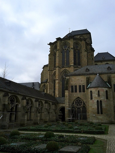
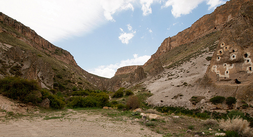
Pictures

Historical Weather
Related Locations
Information of geographic nature is based on public data provided by geonames.org, CIA world facts book, Unesco, DBpedia and wikipedia. Weather is based on NOAA GFS.