-
You are here:
- Homepage »
- Greece »
- Central Greece » Ayia Anna

Ayia Anna Destination Guide
Delve into Ayia Anna in Greece
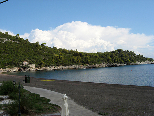
Ayia Anna in the region of Central Greece with its 823 residents is a city in Greece - some 64 mi or ( 102 km ) North of Athens , the country's capital .
Current time in Ayia Anna is now 03:15 AM (Monday) . The local timezone is named " Europe/Athens " with a UTC offset of 2 hours. Depending on your travel modalities, these larger destinations might be interesting for you: Vasilika, Troupion, Strofilia, Skepasti, and Prokopion. While being here, make sure to check out Vasilika . We encountered some video on the web . Scroll down to see the most favourite one or select the video collection in the navigation. Are you curious about the possible sightseeing spots and facts in Ayia Anna ? We have collected some references on our attractions page.
Videos
club agia anna resort
club agias annas ..
Manu Chao - Clandestino
Alone I go with my sorrow Alone goes my sentence To run is my destiny To escape the law Lost in the heart of the great Babylon They call me clandestine For not having any papers To a city of the north ..
GREECE North Evia, Limni
GREECE North Evia, Limni 40 MILES ..
Club Agia Anna (By Miltos-2009)
Camping-Bangalows:Club Agia Anna-Eyoia,poolside ..
Videos provided by Youtube are under the copyright of their owners.
Interesting facts about this location
Agia Anna, Euboea
Agia Anna is a village and a community in the municipal unit Nileas, in northern part of the island Euboea, Greece. The community includes the seaside village Agkali (Αγκάλι). At about 7 km, it has one of the longest beaches in Europe. It lies 12 km northeast of Limni and 47 km north of Chalkida. During winter, there are about 1000 inhabitants, with the number increasing highly during summer to around 7000 people. The commune is also famous for some of the best camping in Greece.
Located at 38.86 23.40 (Lat./Long.); Less than 1 km away
Greek National Road 77
Greek National Road 77 is a national highway on the island of Euboea, Greece. It connects Chalcis with Aidipsos via Agia Anna and Istiaia.
Located at 38.84 23.42 (Lat./Long.); Less than 4 km away
Spathari
Spathari is a village and a community in the north-center of the island of Euboea in Greece. The community had a population of 381 in 2001. It is part of the municipal unit Kireas.
Located at 38.76 23.43 (Lat./Long.); Less than 12 km away
Telethrio
Telethrio is a small mountain range in the northwestern part of the island of Euboea, Greece. Its maximum elevation is 970 m. It stretches along the west coast of the island, on the North Euboean Gulf, from Aidipsos in the west to Rovies in the east. Its length is about 16 km from east to west. The mountains are forested. There are few villages on the steep southern slope.
Located at 38.87 23.19 (Lat./Long.); Less than 18 km away
Kantili
Kantili is a mountain range in the northwestern part of the island of Euboea in Greece. Its maximum elevation is 1,246 m. It stretches along the west coast of the island, above the shore of the North Euboean Gulf, between Limni and Politika. Its length is about 25 km from southeast to northwest. The slope towards the sea is very steep, and there is no road along the coast. The Greek National Road 77 passes east of the mountains.
Located at 38.70 23.43 (Lat./Long.); Less than 19 km away
Pictures
Historical Weather
Related Locations
Information of geographic nature is based on public data provided by geonames.org, CIA world facts book, Unesco, DBpedia and wikipedia. Weather is based on NOAA GFS.