-
You are here:
- Homepage »
- Hong Kong »
- Hong Kong (general) » Yung Shue Wan

Yung Shue Wan Destination Guide
Discover Yung Shue Wan in Hong Kong
Yung Shue Wan in the region of Hong Kong (general) with its 6,000 habitants is a town located in Hong Kong - some 4 mi or ( 7 km ) South-West of Hong Kong , the country's capital .
Local time in Yung Shue Wan is now 07:35 AM (Wednesday) . The local timezone is named " Asia/Hong Kong " with a UTC offset of 8 hours. Depending on your flexibility, these larger cities might be interesting for you: Zhuhai, Shenzhen, Shantou, Huizhou, and Haikou. When in this area, you might want to check out Zhuhai . We found some clip posted online . Scroll down to see the most favourite one or select the video collection in the navigation. Are you looking for some initial hints on what might be interesting in Yung Shue Wan ? We have collected some references on our attractions page.
Videos
2011 Tin Hau Birthday@ Lamma Island (1 Hour Edition)
This is an video about celebration for Tin Hau birthday (God of the sea). Lamma Island Sok Kwu Wan Tin Hau Temple May 20, 2011 Keung Wai Chung Dragon & Lion Dance Team ..
Typhoon Nesat brushes Hong Kong - Lamma Island
Views of Yung Shue Wan on Lamma Island on the morning of 29th September 2011. The T3 signal was in effect at midnight. However the warning level went up to T8 during the night. No ferries were running ..
My Place on Lamma in Hongkong
Hello. I am back nearly 6 months. I got a place on lamma island in hongkong. you can search it on google earth. ..
【Eco Travel 綠恒生態】海上漁排宿營初體驗
香港漁民文化及地質資源新體驗是一個創新的地結合香港漁民文化及香港地理及地質特色兩大主題的新行程,讓我們親身體會香港漁民文化及作業模式、認識與漁民生活息息相關的香港海洋生態系統及資源。 ..
Videos provided by Youtube are under the copyright of their owners.
Interesting facts about this location
Yung Shue Wan
Yung Shue Wan (Chinese: 榕樹灣, Banyan Bay) is the main population centre on Lamma Island, Hong Kong. It has a population of approximately 6,000.
Located at 22.23 114.11 (Lat./Long.); Less than 1 km away
East Lamma Channel
The East Lamma Channel is a sea channel in Hong Kong. It lies between the western shores of Hong Kong Island and Ap Lei Chau, and the east side of Lamma Island. To the north it leads into the Sulphur Channel and Victoria Harbour, to the south into the South China Sea. The East Lamma Canal is one of the areas in the world with the heaviest traffic with more than 150 deep water vessels of all kinds passing there every day.
Located at 22.24 114.13 (Lat./Long.); Less than 2 km away
Waterfall Bay, Hong Kong
Waterfall Bay is a bay on the coast of Wah Fu Estate, Southern District, Hong Kong.
Located at 22.25 114.13 (Lat./Long.); Less than 3 km away
Wah Fu
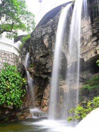
Wah Fu is an area located in Southern District, on Hong Kong Island, Hong Kong. Wah Fu mainly consists of the public housing estates, Wah Fu Estate and Wah Kwai Estate. They were built near Waterfall Bay (瀑布灣) and Kellett Bay (雞籠灣). The area also has a notable beach known as Waterfall Bay (瀑布灣). It is long believed that the waterfall at Waterfall Bay Park attracted British ships coming to Hong Kong to fetch fresh water after their long journey.
Located at 22.25 114.14 (Lat./Long.); Less than 3 km away
Pok Fu Lam Road
Pokfulam Road, or Pok Fu Lam Road, is a four-lane road in Hong Kong. Built on Hong Kong Island, the road runs between Sai Ying Pun and Wah Fu, through Pok Fu Lam. It runs south from Sai Ying Pun, passing The University of Hong Kong along the Belcher's, with a road junction with Pokfield Road. The vegetation in this area is largely preserved, unlike many roads in the urban built-up areas of Hong Kong.
Located at 22.26 114.14 (Lat./Long.); Less than 3 km away
Pictures
Historical Weather
Related Locations
Information of geographic nature is based on public data provided by geonames.org, CIA world facts book, Unesco, DBpedia and wikipedia. Weather is based on NOAA GFS.

