Delve into Kalaikunda in India
Kalaikunda in the region of Bengal with its 3,232 residents is a city in India - some 761 mi or ( 1224 km ) South-East of New Delhi , the country's capital .
Current time in Kalaikunda is now 02:02 AM (Thursday) . The local timezone is named " Asia/Kolkata " with a UTC offset of 5.5 hours. Depending on your travel modalities, these larger destinations might be interesting for you: Rajshahi, Dhaka, Shyamalpur, Saora, and Ranchi. While being here, make sure to check out Rajshahi . We encountered some video on the web . Scroll down to see the most favourite one or select the video collection in the navigation. Are you curious about the possible sightseeing spots and facts in Kalaikunda ? We have collected some references on our attractions page.
Videos
Video Collage Infomercial
A short infomercial made by us for the ad designing event Marca De Fabrica at IIT Kharagpur's tech fest Kshitij '09. The infomercial was aimed at promoting a fictitious company JeNSaL The major produc ..
This is how RPians celebrate Diwali: Gold in Illumination, Silver in Rangoli, IIT Kharagpur
RP illumination in different stages, and rangoli. Diwali 2010: A wonderful day to be an RPian. Illumination and Rangoli are inter hall events at IIT Kharagpur, in which most halls (10+) participate. T ..
Go With The Flow (HD) - Your Film Festival Entry
A short movie by a bunch of 20 year old film-makers from India. All copyrights for every material used in the movie are solely owned by us. Go with the flow is a story about Rambo told through Maggie' ..
Spiderman 3 - The Game - (Bird?)Spider's Eye View
From the top of the tallest(I couldn't find any other structure); I am seeing the whole of the New York city(Virtual). Recorded using FRAPS 3.4.2 ..
Videos provided by Youtube are under the copyright of their owners.
Interesting facts about this location
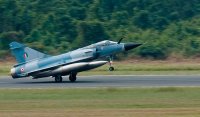
Kalaikunda Air Force Station
Kalaikunda Air Force Station is an Indian Air Force Base near Kharagpur, located in the Midnapore West district of the state of West Bengal. It is the home of No. 18 Squadron IAF, the Flying Bullets. The squadron flies the Indian license-built Mikoyan MiG-27ML.
Located at 22.34 87.21 (Lat./Long.); Less than 4 km away
Kharagpur I (community development block)
Kharagpur I (community development block) is an administrative division in the Kharagpur subdivision of Paschim Medinipur district in the Indian state of West Bengal. Kharagpur police station serves this block. Headquarters of this block is at Matkatpur. Kharagpur Railway Settlement is a census town under this block.
Located at 22.31 87.23 (Lat./Long.); Less than 5 km away
Indian Institute of Technology Kharagpur
The Indian Institute of Technology Kharagpur (IIT Kharagpur or IIT KGP) is a public engineering, management and law institution established by the government of India in 1951. The first of the IITs to be established, it is recognised as an Institute of National Importance by the government of India. The institute was established to train scientists and engineers after India attained independence in 1947.
Located at 22.32 87.31 (Lat./Long.); Less than 7 km away
Kharagpur railway station
Kharagpur is a railway station in Kharagpur subdivision of Paschim Medinipur district in the Indian state of West Bengal.
Located at 22.34 87.32 (Lat./Long.); Less than 8 km away
Kharagpur
Kharagpur pronunciation is an industrial town in Paschim Medinipur district of West Bengal, India. At Kharagpur is one of the prestigious Indian Institutes of Technology (IITs), and one of the biggest railway workshops in India with the 3rd longest railway platform in the world (1072.5 m). Kharagpur has an Air Force station in Kalaikunda and it also has one more station present in Salua. There have been plans by the IAF to allow civil flights in Kalaikunda.
Located at 22.33 87.32 (Lat./Long.); Less than 8 km away
Pictures
Historical Weather
Related Locations
Information of geographic nature is based on public data provided by geonames.org, CIA world facts book, Unesco, DBpedia and wikipedia. Weather is based on NOAA GFS.


