-
You are here:
- Homepage »
- India »
- Uttarakhand » Dwarahat

Dwarahat Destination Guide
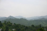
Explore Dwarahat in India
Dwarahat in the region of Uttarakhand with its 2,443 inhabitants is a town in India - some 155 mi or ( 249 km ) North-East of New Delhi , the country's capital city .
Current time in Dwarahat is now 01:31 AM (Friday) . The local timezone is named " Asia/Kolkata " with a UTC offset of 5.5 hours. Depending on the availability of means of transportation, these more prominent locations might be interesting for you: Ranikhet, New Delhi, Lucknow, Jaipur, and Dehra Dun. Since you are here already, make sure to check out Ranikhet . We encountered some video on the web . Scroll down to see the most favourite one or select the video collection in the navigation. Where to go and what to see in Dwarahat ? We have collected some references on our attractions page.
Videos
Mahavatar Babaji Part 5 of 8
www.divyodaya.wordpress.com ..
India Uttarakhand Ranikhet Dunagiri NatureRetreat India Hotels Travel Ecotourism Travel To Care
Visit us at www.traveltocare.com A presentation of Travel To Care for Hotel Dunagiri NatureRetreat Ranikhet in Uttarakhand India Hotels India Travel Ecotourism. ..
Dunagiri Retreat
Dunagiri Retreat Dunagiri Retreat is located in the lush Himalayan foothills of Uttarakhand, India. Dunagiri Retreat offers a variety of tours, which immerse our guests in a richly layered experience, ..
Panchakarma- A powerful Ayurvedic Treatment Pt.1 of 3
Talk with Dr .Vijay, Medical Superintendent of the Bhole Baba Ayurvedic Hospital and Research Centre, Chilianaula, India, about what Panchakarma is and what it is good for..www.babajiayurveda.org ..
Videos provided by Youtube are under the copyright of their owners.
Interesting facts about this location
Dwarahat
Dwarahat is a town and a nagar panchayat in Almora district in the state of Uttarakhand, India.
Located at 29.78 79.43 (Lat./Long.); Less than 0 km away
Chaukhutia
Chaukhutia is a small town in Almora district of Uttarakhand located at banks of river Ramganga. This picturesque place derives its name from a Kumaoni word Chau-khut which means four feet. In Chaukhutia's context four feet means four ways. Fist way is towards Ramnagar, second towards Karanprayag, third towards Ranikhet and Almora and the fourth way is towards Tadaktaal, Kheera. From here the entire region is easily accessible.
Located at 29.88 79.35 (Lat./Long.); Less than 14 km away
Baijnath, Uttarakhand
For the village of the same name in Himachal Pradesh, see Baijnath, Himachal Pradesh Baijnath — town — A temple at Baijnath Baijnath, Uttarakhand is located in UttarakhandBaijnathBaijnath Coordinates: {{#invoke:Coordinates|coord}}{{#coordinates:29.92|N|79.62|E|type:city_region:IN-X|||| |primary |name= }} Country 22x20px India State Uttarakhand District Bageshwar Time zone IST Baijnath is a small town on the banks of the Gomti River in the Bageshwar district of Uttarakhand, India.
Located at 29.92 79.62 (Lat./Long.); Less than 24 km away
Mehalchauri
Mehalchauri is a village in Gairsain Mandal, Chamoli district, Uttarakhand, India. Mehalchauri is religious placee. Mehalchauri is the main market for Harshari,Pharso,Agarchatti,Latoogair and Many other villages Mehalchauri is 125 km from the state capital Dehradun. Ram Ganga Pul bridge was built in 1963. it connects Chaukhuttiya and Maithan Road to Gairsain. Every Year in the month of June the Mehalchauri People's Concert and Criket Tournament is held.
Located at 29.98 79.32 (Lat./Long.); Less than 25 km away
Pictures
Historical Weather
Related Locations
Information of geographic nature is based on public data provided by geonames.org, CIA world facts book, Unesco, DBpedia and wikipedia. Weather is based on NOAA GFS.


