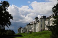
Discover Newcastle in Ireland
Newcastle in the region of Leinster is a town located in Ireland - some 11 mi or ( 17 km ) West of Dublin , the country's capital .
Local time in Newcastle is now 10:26 AM (Friday) . The local timezone is named " Europe/Dublin " with a UTC offset of 0 hours. Depending on your flexibility, these larger cities might be interesting for you: Liverpool, Lisburn, Glasgow, Enniskillen, and Edinburgh. When in this area, you might want to check out Liverpool . We found some clip posted online . Scroll down to see the most favourite one or select the video collection in the navigation. Are you looking for some initial hints on what might be interesting in Newcastle ? We have collected some references on our attractions page.
Videos
Official An Comhdhail World Irish Dancing Championships 2012
www.dundaraproductions.ie video of the opening sequence from the forthcoming DVD of the 2012 World Championships held at Citywest, Co. Dublin. ..
Weston Airport Ireland
Weston Airport is the only executive airport in Dublin. It is situated just 8 miles (13km) from the city centre and opened in 1931. Weston caters exclusively to the private and executive air travel ma ..
Irish Rail 201 Class - Mk4 + Craven + Enterprise Trains
Irish Rail 201 Class locomotives hauling Enterprise, Mk4 and Craven trains, filmed around Dublin and Kildare, Ireland. *226 & 221 on Dublin-Cork expresses at Stacumny Bridge, Hazelhatch, Co.Kildare. * ..
Blakestown Level Crossing at Rush Hour
A collection of clips shot at Blakestown Level Crossing between Maynooth and Leixlip during the evening rush hour on the 7th of march. Clip 1: Irish Rail Class 29000 four-car DMU number 29005 working ..
Videos provided by Youtube are under the copyright of their owners.
Interesting facts about this location
Hazelhatch
Hazelhatch is an area on the border between County Kildare and South Dublin in Ireland. It is located approximately halfway between Celbridge and Newcastle. It is located on the R405 regional road. The Grand Canal passes through the area, and Hazelhatch is one of the places of recreational activity along the Grand Canal, with fishing and boating. There is one pub in Hazelhatch, beside the canal.
Located at 53.32 -6.52 (Lat./Long.); Less than 3 km away
Celbridge GAA
Celbridge is a Gaelic Athletic Association club in Celbridge, County Kildare, Ireland. They were awarded Kildare GAA club of the year in 2008, winners of the Kildare senior football championship of 2008, finalists in the senior football league of 1923, 1988 and 2008 and won the Kildare senior hurling and camogie championships in 2005.
Located at 53.33 -6.53 (Lat./Long.); Less than 3 km away
Casement Aerodrome
Casement Aerodrome (Irish: Aeradróm Mhic Easmainn) or Baldonnel Aerodrome is a military airfield to the south west of Dublin, Ireland situated off the N7 main road route to the south and south west. It is the headquarters and the sole airfield of the Irish Air Corps, and is also used for other government purposes. It is the property of the Irish Department of Defence.
Located at 53.30 -6.45 (Lat./Long.); Less than 3 km away
Lyons Hill
Lyons Hill is a restored village, and former parish with church, now part of the community of Ardclough in north County Kildare. At a time when canal passenger boats travelled at 3 mph Lyons was the nearest overnight stop to Dublin on the Grand Canal. On the hilltop is a trigonometrical point used by Ireland's Ordnance Survey. The name derives from the Irish language name for elm tree, Liamhan.
Located at 53.30 -6.56 (Lat./Long.); Less than 4 km away
Ardclough GAA
50x40pxThis article includes a list of references, related reading or external links, but its sources remain unclear because it lacks inline citations. Please improve this article by introducing more precise citations. Ardclough GAA Ard ClochFounded: 1936County: KildareNickname: The ClocksGrounds: Dan Graham Memorial ParkCoordinates: {{#invoke:Coordinates|coord}}{{#coordinates:53.296324|N|6.565962|W|region:IE_type:landmark|||| |primary |name= }}Playing kits <span/> File:Kit left arm.
Located at 53.30 -6.57 (Lat./Long.); Less than 4 km away
Pictures
Related Locations
Information of geographic nature is based on public data provided by geonames.org, CIA world facts book, Unesco, DBpedia and wikipedia. Weather is based on NOAA GFS.


