
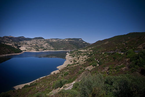
Discover Esterzili in Italy
Esterzili in the region of Sardinia with its 844 habitants is a town located in Italy - some 222 mi or ( 357 km ) South-West of Rome , the country's capital .
Local time in Esterzili is now 05:27 AM (Sunday) . The local timezone is named " Europe/Rome " with a UTC offset of 1 hours. Depending on your flexibility, these larger cities might be interesting for you: Tunis, Villacidro, Ussassai, Seulo, and Serri. When in this area, you might want to check out Tunis . We found some clip posted online . Scroll down to see the most favourite one or select the video collection in the navigation. Are you looking for some initial hints on what might be interesting in Esterzili ? We have collected some references on our attractions page.
Videos
Sardegna NIALA Ponte Irtzioni Linea Trenino Verd
Sardegna Sardinia NIALA Ponte Irtzioni Linea Trenino Verde ..
Villanovatulo to Betilli
Sardinian narrow gauge 2-6-2T steam loco attacks the long fierce climb between Villanovatuli and Betilli on the line from Mandas to Arbatax 22nd October 2009 ..
Seui. Su Prugadoriu 2010. Large Street Band.
Large Street Band per le vie di Seui durante "Su Prugadoriu 2010". ..
Ajò in pullman a... Seui per Su Prugadoriu
www.ajoinpullmana.it - Ajò in pullman a... Seui per Su Prugadoriu 01/11/2012 ..
Videos provided by Youtube are under the copyright of their owners.
Interesting facts about this location
Barbagia di Seulo
The Barbagia di Seulo is a historical subregion of central-eastern Sardinia, Italy. It includes the communes of Seulo, Seui, Sadali, Esterzili and Ussassai.
Located at 39.87 9.23 (Lat./Long.); Less than 10 km away
Trexenta
Trexenta is a traditional subregion of Sardinia, Italy, located in the northern part of the province of Cagliari. It encompasses an area of c. 400 km², including 13 municipalities. The terrain is mostly hilly in the eastern part, becoming more plain southwards. Economy is mostly based on agriculture, with the cultivation of cereals, olives and vines. In the Middle Ages it was part of the Giudicato of Cagliari.
Located at 39.63 9.15 (Lat./Long.); Less than 21 km away
Funtana Coberta
Funtana Coberta is a holy pit (subterranean temple) in Sarrabus-Gerrei, a traditional subregion of Sardinia, Italy. Dating to c. 1200-850 BC, it is included in the territory of Ballao, in the province of Cagliari. It was excavated in 1918 by Antonio Taramelli, and again in 1994 by Maria Rosaria Manunza. It is composed of roughly parallelepiped-shaped limestone rocks, with a length of 10.60 m.
Located at 39.58 9.35 (Lat./Long.); Less than 23 km away
Pictures
Historical Weather
Related Locations
Information of geographic nature is based on public data provided by geonames.org, CIA world facts book, Unesco, DBpedia and wikipedia. Weather is based on NOAA GFS.