
Delve into Irgoli in Italy
Irgoli in the region of Sardinia with its 2,294 residents is a city in Italy - some 180 mi or ( 290 km ) South-West of Rome , the country's capital .
Current time in Irgoli is now 03:13 PM (Friday) . The local timezone is named " Europe/Rome " with a UTC offset of 1 hours. Depending on your travel modalities, these larger destinations might be interesting for you: Tunis, Villacidro, Terralba, Palermo, and Oristano. While being here, make sure to check out Tunis . We encountered some video on the web . Scroll down to see the most favourite one or select the video collection in the navigation. Are you curious about the possible sightseeing spots and facts in Irgoli ? We have collected some references on our attractions page.
Videos
Calendario 2011 Una finestra su Onifai
Presentazione calendario con immagini fotografiche di Onifai (Nuoro) ..
Honda Four in Sardegna
Me riding my Honda CB500 Four on the SS125 in Sardinia, Summer 2007; ..
O sole mio - singender Busfahrer
Busfahrer animiert die Ausflügler zum Mitsingen. Bus driver encouraged to sing. Autista di autobus ha incoraggiato a cantare. Aufgenommen bei einer Fahrt in Sardinien veranstaltet durch Humboldt Reise ..
Locanda Murru di Malpensa - Distribuzione Prodotti Murru in LOMBARDIA
Vi diamo il benvenuto alla Locanda Murru di Malpensa. La nostra struttura ha una posizione strategica trovandosi a soli 2 km dal Terminal 2 e il Terminal 1 dell' aeroporto internazionale di Milano Mal ..
Videos provided by Youtube are under the copyright of their owners.
Interesting facts about this location
Monte Albo
The Monte Albo is a limestone massif 13 kilometres, in the central eastern portion of Island of Sardinia, Italy. Punta Ferulargiu, 1,057 metres, is the highest point.
Located at 40.53 9.58 (Lat./Long.); Less than 14 km away
La Caletta
La Caletta is a small town, a touristic harbour and a touristic destination in Sardinia, Italy. Caletta means a small bay or little harbour. The town is located approximately 50 km south of Olbia, in the administrative territory of Siniscola, on the Tyrrhenian coast of the island. An ancient village of fishermen, its small gulf has been transformed in the 1970s into a touristic harbour, and recently renewed and enlarged. The town (est.
Located at 40.58 9.70 (Lat./Long.); Less than 20 km away
Tiscali (Tiscali Village)
Tiscali Village is an archaeological site situated in Sardina, in the comune of Dorgali. It is situated within a large cave in Monte Tiscali. It consists of the remains of a number of round dwellings dating from the first millennium BC. The site was re-discovered a little over a century ago and was first documented by the Italian historian Ettore Pais in 1910 and then in greater detail by Antonio Taramelli in 1927.
Located at 40.24 9.49 (Lat./Long.); Less than 23 km away
Supramonte
The Supramonte is an area of mountains and highlands located in central-eastern Sardinia, Italy. It lies northeast of the Gennargentu massif, spanning eastwards until it reaches the Tyrrenian See in the Gulf of Orosei. It has an extension of about 35,000 hectares, encompassing most of the territories of the comuni (municipalities) of Baunei, Dorgali, Oliena, Orgosolo, and Urzulei.
Located at 40.24 9.43 (Lat./Long.); Less than 25 km away
San Giovanni di Posada
San Giovanni di Posada is a frazione and small village in Sardinia, Italy, on the Tyrrhenian coast of the island, in the territory of the comune of Posada. Formerly known as Marina di Posada, it underwent rebuilding in the 1970s as an elegant residential village for holidays. Its history goes back to the Roman harbour (named "Portus Luguidonis" - presumably located in the little bay in front of the ancient church of St. John), from where the Romans entered inner Sardinia.
Located at 40.62 9.75 (Lat./Long.); Less than 25 km away
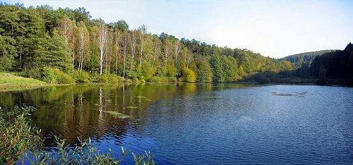
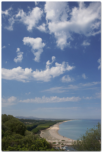
Pictures
Historical Weather
Related Locations
Information of geographic nature is based on public data provided by geonames.org, CIA world facts book, Unesco, DBpedia and wikipedia. Weather is based on NOAA GFS.