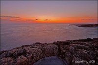
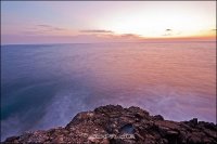
Explore Brucoli in Italy
Brucoli in the region of Sicily is a town in Italy - some 349 mi or ( 562 km ) South-East of Rome , the country's capital city .
Current time in Brucoli is now 07:21 AM (Sunday) . The local timezone is named " Europe/Rome " with a UTC offset of 1 hours. Depending on the availability of means of transportation, these more prominent locations might be interesting for you: Villasmundo, Taormina, Sortino, Syracuse, and San Cusumano. Since you are here already, make sure to check out Villasmundo . We saw some video on the web . Scroll down to see the most favourite one or select the video collection in the navigation. Where to go and what to see in Brucoli ? We have collected some references on our attractions page.
Videos
PAN in Sicily
Originally this video was meant to be an internal video sharing, so that the BuddhaHill Commune members in Germany could get a visual impression of the last days and weeks in SiIcily with Pan. Pan and ..
Augusta - bagno di Natale allo Sbarcatore dei Turchi
..
Acquistare in Città - il Centro Commerciale di Augusta (SR), Melilli (SR) e Priolo Gargallo (SR)
Guarda in anteprima il nuovo Centro Commerciale Virtuale 3D che ospiterà la community commerciale delle citttà di Augusta (SR), Melilli (SR) e Priolo Gargallo (SR) solo su www.acquistareincitta.it! Ac ..
vacances siciliennes
Sud de la Sicile : Syracuse, Noto, Caltagirone, Catane, Randazzo, Santa Venera, Taormine, Aci Trezze et L'Etna en éruption ..
Videos provided by Youtube are under the copyright of their owners.
Interesting facts about this location
1693 Sicily earthquake
The 1693 Sicily earthquake refers to a powerful earthquake that struck parts of southern Italy, notably Sicily, Calabria and Malta on January 11, 1693 around 9 pm local time. This earthquake was preceded by a damaging foreshock on January 9.
Located at 37.30 15.10 (Lat./Long.); Less than 8 km away
Augusta Bay (Sicily)
coordinates: 37°13'N 15°14'E The Augusta Bay is located on the east coast of Sicily, Italy, about 270 nm south-southeast of Naples. It is the location of the Auguate Bay Port Facility which supports the Sixth Fleet of the US Navy. The facility is distributed among Porto Megarese, Porto Xifonio and Seno del Priolo.
Located at 37.22 15.23 (Lat./Long.); Less than 9 km away
Simeto
The Simeto is a 113 km long river in Sicily, southern Italy. It is the second longest river on the island after the Salso (also known as Southern Imera), but the most important in terms of watershed and for the population of the areas near it. All of its course is included in the province of Catania. Its source is located near Bronte, from the union of several streams of the Nebrodi Mountains.
Located at 37.40 15.10 (Lat./Long.); Less than 15 km away
Operation Fustian
Operation Fustian was a British airborne forces mission during the Allied invasion of Sicily in the Second World War. The operation was carried out by the 1st Parachute Brigade, part of the 1st Airborne Division. Their objective was the Primosole Bridge across the Simeto River. The intention was for the brigade, with glider-borne forces in support, to land on both sides of the river.
Located at 37.40 15.06 (Lat./Long.); Less than 17 km away
Gornalunga
The Gornalunga is an 81-kilometre-long river located in central-eastern Sicily. The river springs from Monte Rossomanno, on the Erean Mountains, in the province of Enna. After flowing through the plain of Catania, the river becomes an affluent of the Simeto river just few miles before reaching the Mediterranean coast. Along its course, the Gornalunga forms the artificial lake, Lago di Ogliastro, and touches three provinces, Enna, Catania and Syracuse.
Located at 37.40 15.05 (Lat./Long.); Less than 18 km away
Pictures
Historical Weather
Related Locations
Information of geographic nature is based on public data provided by geonames.org, CIA world facts book, Unesco, DBpedia and wikipedia. Weather is based on NOAA GFS.


