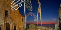
Explore San Marco d'Alunzio in Italy
San Marco d'Alunzio in the region of Sicily with its 2,202 inhabitants is a town in Italy - some 289 mi or ( 465 km ) South-East of Rome , the country's capital city .
Current time in San Marco d'Alunzio is now 08:08 AM (Friday) . The local timezone is named " Europe/Rome " with a UTC offset of 1 hours. Depending on the availability of means of transportation, these more prominent locations might be interesting for you: Tortorici, Torrecandele, Taormina, Syracuse, and Sinagra. Since you are here already, make sure to check out Tortorici . We encountered some video on the web . Scroll down to see the most favourite one or select the video collection in the navigation. Where to go and what to see in San Marco d'Alunzio ? We have collected some references on our attractions page.
Videos
II° Giornata MEDIEVALE 2009__parte 2
II° Giornata MEDIEVALE 02 Giugno 2009 -- Splendida giornata per ritornare in un passato non molto lontano, con Giochi, musica, mercati medievali e degustazioni di prodotti tipici. In conclusione Corte ..
Il difficile - Fabrizio Bentivoglio
da 'Sottotraccia', F. Bentivoglio & Quintetto di musicanormale con la Piccola Orchestra Avion Travel, 2001 Foto MIMMO PRIVITERA www.flickr.com (by annalisa) ..
Io domani Liliana Passeri
..
Festa dei tre Santi Galati Mamertino (ME) 2012
festa dei tre santi a galati mamertino , processione del 26/08/2012 pomerigio ..
Videos provided by Youtube are under the copyright of their owners.
Interesting facts about this location
Lago Maullazzo
Lago Maullazzo is a lake in the Province of Messina, Sicily, Italy. At an elevation of 1400 m, its surface area is 0.05 km².
Located at 37.94 14.67 (Lat./Long.); Less than 15 km away
Lago Trearie
Lago Trearie is a small lake in the Parco Naturale del Nebrodi in the Province of Catania, northeast of Sicily island, Italy.
Located at 37.95 14.84 (Lat./Long.); Less than 18 km away
Nebrodi
The Nebrodi a mountain range that runs along the north east of Sicily. Together with the Madonie and the Peloritani, they form the Sicilian Apennines. The mountains run from the Peloritani on the eastern part of the island to the foothill of the Madonie mountains to the west, facing the Tyrrhenian Sea on the north. Mount Etna, from which it is separated by the rivers Alcantara and Simeto, forms the range's southern border. The highest peak is the Monte Soro (1,817 m).
Located at 37.90 14.58 (Lat./Long.); Less than 22 km away
Pictures
Historical Weather
Related Locations
Information of geographic nature is based on public data provided by geonames.org, CIA world facts book, Unesco, DBpedia and wikipedia. Weather is based on NOAA GFS.


