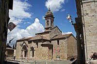
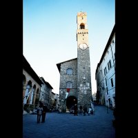
Explore Montalcino in Italy
Montalcino in the region of Tuscany with its 5,118 inhabitants is a town in Italy - some 95 mi or ( 153 km ) North-West of Rome , the country's capital city .
Current time in Montalcino is now 03:28 AM (Thursday) . The local timezone is named " Europe/Rome " with a UTC offset of 1 hours. Depending on the availability of means of transportation, these more prominent locations might be interesting for you: Serravalle, Seggiano, San Quirico d'Orcia, San Giovanni d'Asso, and Rome. Since you are here already, make sure to check out Serravalle . We saw some video on the web . Scroll down to see the most favourite one or select the video collection in the navigation. Where to go and what to see in Montalcino ? We have collected some references on our attractions page.
Videos
Montalcino, Italy - The land of Brunello
A quick peek at the Brunello producing hill town of Montalcino, Italy as presented by www.travelrabbit.net ..
Montalcino flip #1
Just flipping around in Montalcino August 2nd 2008 ..
Montalcino flip #2
Just flipping around in Montalcino August 2nd 2008 ..
Montalcino flip #4
Just flipping around in Montalcino August 2nd 2008 ..
Videos provided by Youtube are under the copyright of their owners.
Interesting facts about this location
Val d'Orcia
The Val d’Orcia, or Valdorcia, is a region of Tuscany, central Italy, which extends from the hills south of Siena to Monte Amiata.
Located at 43.07 11.55 (Lat./Long.); Less than 5 km away
Abbey of Sant'Antimo
The Abbey of Sant'Antimo, Italian: Abbazia di Sant'Antimo, is a former Benedictine monastery in the comune of Montalcino, Tuscany, central Italy. It is approximately 10 km from Montalcino about 9 km from the Via Francigena, the pilgrim route to Rome. Disused for many years, the abbey has since 1992 been in use by a small community of Premonstratensian Canons Regular. A tributary of the river Orcia, the Starcia, runs near the abbey.
Located at 43.00 11.52 (Lat./Long.); Less than 7 km away
Civitella Marittima
Civitella Marittima is a village in southern Tuscany, in central Italy, administratively part of the municipality of Civitella Paganico, of which it houses the seat. It is located in the valley of the Ombrone river, at 329 metres above sea level. In 2001 it had a population of 517 inhabitants. The town is of Etruscan origins, although the current settlement dates to around 1000 AD.
Located at 42.99 11.45 (Lat./Long.); Less than 8 km away
Arbia
The Arbia is a torrent in Tuscany, central Italy, an affluence of the Ombrone river. Its source is located in the comune of Castellina in Chianti, at 620 m of altitude. it flows into the Ombrone near Buonconvento. The rivers is mentioned by Dante in his Divine Comedy, its waters getting "colored of red" (Inferno, Canto X, verse 86) in the wake of the Battle of Montaperti between Florence and Siena.
Located at 43.14 11.48 (Lat./Long.); Less than 9 km away
Bagno Vignoni
Bagno Vignoni is a town situated on a hill above Val d'Orcia in Tuscany, Italy. It is a popular tourist destination and well known for its hot springs. The ancient village of Bagno Vignoni is located in the heart of Tuscany, in the Val d'Orcia Natural Park. Thanks to the Via Francigena (which was the main route followed by pilgrims in antiquity who went to Rome), these thermal waters were found and have been used since Roman times.
Located at 43.07 11.60 (Lat./Long.); Less than 9 km away
Pictures
Historical Weather
Related Locations
Information of geographic nature is based on public data provided by geonames.org, CIA world facts book, Unesco, DBpedia and wikipedia. Weather is based on NOAA GFS.


