-
You are here:
- Homepage »
- Madagascar »
- Alaotra Mangoro » Moramanga

Moramanga Destination Guide
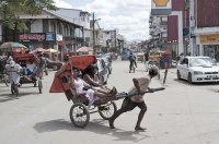
Discover Moramanga in Madagascar
Moramanga in the region of Alaotra Mangoro with its 29,212 habitants is a place located in Madagascar - some 45 mi or ( 73 km ) East of Antananarivo , the country's capital .
Local time in Moramanga is now 12:56 PM (Tuesday) . The local timezone is named " Indian/Antananarivo " with a UTC offset of 3 hours. Depending on your mobility, these larger cities might be interesting for you: Toamasina, Volidasy, Soavinorona, Manja, and Mahajanga. When in this area, you might want to check out Toamasina . We discovered some clip posted online . Scroll down to see the most favourite one or select the video collection in the navigation. Are you looking for some initial hints on what might be interesting in Moramanga ? We have collected some references on our attractions page.
Videos
construction de la maison
construction de la maison ..
Madagascar on My Mind - Megatransect Part 2 of 3 (2004)
Experience a unique cross-section of Madagascar. Travel from the spiny forests in the south to the tropical rainforests. Learn about SRI, or the System of Rice Intensification. Get to know some of the ..
Videos provided by Youtube are under the copyright of their owners.
Interesting facts about this location
Moramanga
Moramanga is a city (commune urbaine) in Madagascar. Between the capital city Antananarivo and the east coast. The name Mora-manga literally means “cheap mangoes”. The city of Moramanga has an important place in the history of Madagascar. It was in Moramanga, on the night of the 29th of March 1947 that the Malagasy uprising against French colonial rule started. Moramanga is also the capital city of the Bezanozano tribe (one of the eighteen tribes in Madagascar).
Located at -18.95 48.23 (Lat./Long.); Less than 0 km away
Moramanga Suburbaine
Moramanga Suburbaine is a town and commune in Madagascar. It belongs to the district of Moramanga, which is a part of Alaotra-Mangoro Region. The population of the commune was estimated to be approximately 17,000 in 2001 commune census. Moramanga Suburbaine is served by a local airport. Primary and junior level secondary education are available in town. The majority 80% of the population of the commune are farmers.
Located at -18.94 48.23 (Lat./Long.); Less than 1 km away
Ampasipotsy Mandialaza
Ampasipotsy Mandialaza (or simply Ampasipotsy) is a town and commune in Madagascar. It belongs to the district of Moramanga, which is a part of Alaotra-Mangoro Region. The population of the commune was estimated to be approximately 6,000 in 2001 commune census. Only primary schooling is available. The majority 88% of the population of the commune are farmers. The most important crop is rice, while other important products are beans and cassava.
Located at -18.97 48.34 (Lat./Long.); Less than 12 km away
Ampasipotsy Gare
Ampasipotsy Gare is a town and commune in Madagascar. It belongs to the district of Moramanga, which is a part of Alaotra-Mangoro Region. The population of the commune was estimated to be approximately 7,000 in 2001 commune census. Only primary schooling is available. 70% of the population of the commune are farmers, while an additional 1% receive their livelihood from raising livestock. The most important crop is rice, while other important products are cassava and sweet potatos.
Located at -18.97 48.35 (Lat./Long.); Less than 13 km away
Antaniditra
Antaniditra is a town and commune in Madagascar. It belongs to the district of Moramanga, which is a part of Alaotra-Mangoro Region. The population of the commune was estimated to be approximately 6,000 in 2001 commune census. Primary and junior level secondary education are available in town. The majority 99% of the population of the commune are farmers. The most important crop is rice, while other important products are beans and cassava. Services provide employment for 1% of the population.
Located at -18.85 48.37 (Lat./Long.); Less than 18 km away
Pictures
Historical Weather
Related Locations
Information of geographic nature is based on public data provided by geonames.org, CIA world facts book, Unesco, DBpedia and wikipedia. Weather is based on NOAA GFS.

