
Explore Nadur in Malta
Nadur in the region of In-Nadur with its 3,933 inhabitants is a place in Malta - some 16 mi or ( 25 km ) North-West of Valletta , the country's capital city .
Time in Nadur is now 05:06 PM (Saturday) . The local timezone is named " Europe/Malta " with a UTC offset of 1 hours. Depending on your budget, these more prominent locations might be interesting for you: Tripoli, Sousse, Vittoria, Syracuse, and Palermo. Since you are here already, consider visiting Tripoli . We saw some hobby film on the internet . Scroll down to see the most favourite one or select the video collection in the navigation. Where to go and what to see in Nadur ? We have collected some references on our attractions page.
Videos
Rough Sea on Easter Sunday Gozo Ferry
Force 8 - rough sea on the Gozo Channel ferry boat 7pm trip from Cirkewwa on Easter Sunday 12th April 2009 ..
Malta.Images of Malta in the past and Malta today.(Part1)
Images of Malta in the past and Malta today. Music by Enya Watch also Malta in the past and Malta today (Part1) www.youtube.com ..
Good Friday Procession Naxxar
Malta good friday processions. Naxxar Parish church. ..
Villa with Pool in Gozo Malta
This family-run holiday house has been recently converted from a 250 year old farm, into a four bedroom luxury house. It is fully furnished and equipped with all essential household appliances. It is ..
Videos provided by Youtube are under the copyright of their owners.
Interesting facts about this location
Ta' Kenuna Tower
Ta' Kenuna Tower is one of three semaphore towers built by the British in 1848 on the cliffs near Nadur in Gozo, Malta. Sited on a hill 130 metres above sea level, its purpose was to pass on signals to ships and other posts via a telegraphy link between the two main Maltese islands. In 2005 the Nadur Local Council with the help of Maltacom sponsored restoration works of the tower.
Located at 36.04 14.28 (Lat./Long.); Less than 1 km away
Megalithic Temples of Malta
The Megalithic Temples of Malta are the oldest free-standing structures on Earth. Eleven prehistoric monuments, of which seven are UNESCO World Heritage Sites, were built during three distinct time periods between 5000BC and 700BC approximately. Archaeologists believe that these megalithic complexes are the result of local innovations in a process of cultural evolution.
Located at 36.05 14.27 (Lat./Long.); Less than 3 km away
Ġgantija
Ġgantija is a Neolithic, megalithic temple complex on the Mediterranean island of Gozo. The Ġgantija temples are the earliest of a series of megalithic temples in Malta. The Ġgantija temples are older than the pyramids of Egypt. Their makers erected the two Ġgantija temples during the Neolithic Age (c. 3600-2500 BC), which makes these temples more than 5500 years old and the world's second oldest manmade religious structures, after Göbekli Tepe.
Located at 36.05 14.27 (Lat./Long.); Less than 3 km away
Ramla Bay
This article is about Ramla Bay in Gozo. There is another Ramla Bay near Marfa, Mellieha (Island of Malta). Ramla Bay is located at the bottom of a rich and fertile valley on the northern side of the island of Gozo. Gozo is one of the Maltese islands. The village of Xagħra, located on one of the hills of Gozo, overlooks this valley. It is about a forty-minute walk from Xagħra to the bay. The bay can also be reached from the village of Nadur. Bus service to the beach is very regular.
Located at 36.06 14.28 (Lat./Long.); Less than 3 km away
Brochtorff Circle
The Brochtorff Circle at Xagħra, one of possibly TWO stone Circles at Xagħra, but also more simply known without distinction, as the Xagħra Stone Circle, is an underground Neolithic burial complex, situated in Xagħra on the Maltese island of Gozo. It was first discovered by John Otto Bayer in the 1820s and rediscovered in 1964 after Gozitan researcher Joe Attard Tabone examined a painting by Charles Brochtorff in the National Library in Valletta.
Located at 36.05 14.26 (Lat./Long.); Less than 3 km away
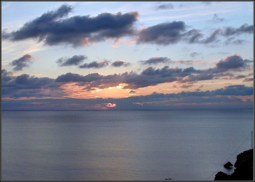
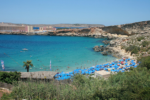
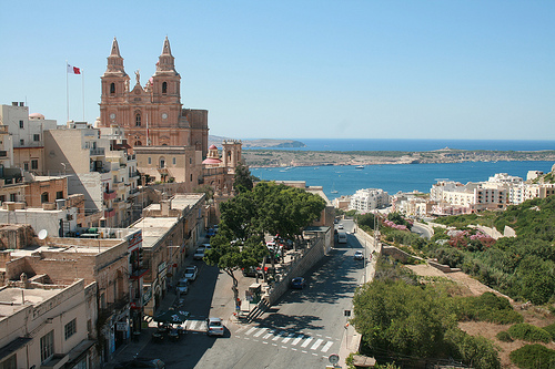
Pictures


Historical Weather
Related Locations
Information of geographic nature is based on public data provided by geonames.org, CIA world facts book, Unesco, DBpedia and wikipedia. Weather is based on NOAA GFS.