-
You are here:
- Homepage »
- Norway »
- More og Romsdal » Elnesvagen

Elnesvagen Destination Guide
Discover Elnesvagen in Norway
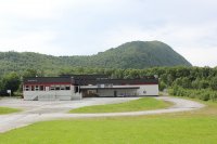
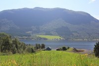
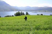
Elnesvagen in the region of Møre og Romsdal is a town located in Norway - some 236 mi or ( 379 km ) North-West of Oslo , the country's capital .
Local time in Elnesvagen is now 11:14 AM (Monday) . The local timezone is named " Europe/Oslo " with a UTC offset of 1 hours. Depending on your flexibility, these larger cities might be interesting for you: Volda, Vikan, Trondheim, Tornes, and Stavanger. When in this area, you might want to check out Volda . We found some clip posted online . Scroll down to see the most favourite one or select the video collection in the navigation. Are you looking for some initial hints on what might be interesting in Elnesvagen ? We have collected some references on our attractions page.
Videos
Hiking in the Romsdalseggen Ridge
The Romsdaleggen Ridge starts and ends in Åndalsnes, and is a day tour with magnificent views over the Romsdalsfjord, the Trollveggen wall and Romsdalshorn. ..
59. ENML, Landing Molde 07, 13.05.2009
ENML, Landing Molde 07, 13.05.2009 ..
Norway, Varden - Molde panorama
Varden - the Molde panorama. Viewpoint - 407 mas 222 partialy snow-clad peaks. ..
63. ENML, Molde landing 07, 13.05.2009
13.05.2009, ENML, Landing 07 ..
Videos provided by Youtube are under the copyright of their owners.
Interesting facts about this location
Frænfjorden
The Frænfjorden is a fjord in the municipality of Fræna in Møre og Romsdal county, Norway. The approximately 12-kilometre long fjord flows from Malmefjorden to the Julsund strait near the island of Gossa. The villages of Malme, Sylte, Elnesvågen, Aureosen, and Tornes are all located along the shores of the fjord. There are many small islands scattered throughout the fjord.
Located at 62.83 7.07 (Lat./Long.); Less than 4 km away
Såta
Såta is the highest point on the island of Stolmen in Austevoll, Norway. The top is 60 metres high.
Located at 62.78 7.18 (Lat./Long.); Less than 8 km away
Moldevatnet
Moldevatnet (Lake Molde) is the main reservoir and water supply for the city of Molde in Møre og Romsdal county, Norway. The 19-hectare lake is the source of the river Moldeelva and it is located about 4 kilometres north of the city of Molde, and the north end lies about 200 metres southeast of the municipal border with Fræna.
Located at 62.78 7.18 (Lat./Long.); Less than 9 km away
Tussen Tunnel
The Tussen Tunnel is a 2,840-meter long road tunnel located on County Road 64 in Molde, Norway. It opened on 13 October 1990 to shorten County Road 64; however, the tunnel is privately owned and was originally not officially part of the county road. The tunnel is owned by Tusten Tunnelselskap AS, which is owned by several local municipalities and banks. The tunnel has 5,000 daily vehicles.
Located at 62.78 7.25 (Lat./Long.); Less than 10 km away
Moldeelva
The Moldeelva (Molde River) runs through Moldemarka and through the city of Molde in Møre og Romsdal county, Norway. Its origins are found at the lake Moldevatnet. It follows Moldedalen (Molde valley) on its way to Moldefjord. The approximately 5-kilometre long river is crossed by several bridges. Although the river is minor and seasonal, there were several sawmills along its course in the 17th and 18th centuries.
Located at 62.76 7.18 (Lat./Long.); Less than 11 km away
Pictures
Historical Weather
Related Locations
Information of geographic nature is based on public data provided by geonames.org, CIA world facts book, Unesco, DBpedia and wikipedia. Weather is based on NOAA GFS.


