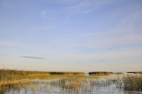
Explore Borisova Griva in Russia
Borisova Griva in the region of Leningrad with its 1,032 inhabitants is a town in Russia - some 386 mi or ( 621 km ) North-West of Moscow , the country's capital city .
Current time in Borisova Griva is now 07:00 PM (Thursday) . The local timezone is named " Europe/Moscow " with a UTC offset of 4 hours. Depending on the availability of means of transportation, these more prominent locations might be interesting for you: Rēzekne, Shlissel'burg, Sheremet'yevka, Leningrad, and Rakh'ya. Since you are here already, make sure to check out Rēzekne . We saw some video on the web . Scroll down to see the most favourite one or select the video collection in the navigation. Where to go and what to see in Borisova Griva ? We have collected some references on our attractions page.
Videos
lake Ladoga decevber 2009
..
Winterkart race
www.petrokart.ru ..
Videos provided by Youtube are under the copyright of their owners.
Interesting facts about this location
Shlisselburg
Shlisselburg is a town in Kirovsky District of Leningrad Oblast, Russia, located at the head of the Neva River on Lake Ladoga, 35 kilometers east of St. Petersburg. From 1944 to 1992, it was known as Petrokrepost. Population: 13,170; 12,401; 12,589. The fortress and the city center are UNESCO World Heritage Sites.
Located at 59.95 31.03 (Lat./Long.); Less than 16 km away
Ladozhsky Bridge
Ladozhsky Bridge is uppermost bridge across the Neva River. It is located in Leningrad Oblast, near Kirovsk. It is a part of Murmansk Highway.
Located at 59.91 30.99 (Lat./Long.); Less than 20 km away
Sinyavino Offensive (1942)
The Sinyavino Offensive was an operation planned by the Soviet Union with the aim of breaking the German blockade and establish a reliable supply line to Leningrad which was under siege for almost a year. At the same time, German forces were planning Operation Northern Light to capture the city and link up with Finnish forces. To achieve that heavy reinforcements were arriving from Sevastopol, which the German forces captured in July 1942.
Located at 59.91 31.08 (Lat./Long.); Less than 21 km away
Pictures
Historical Weather
Related Locations
Information of geographic nature is based on public data provided by geonames.org, CIA world facts book, Unesco, DBpedia and wikipedia. Weather is based on NOAA GFS.


