-
You are here:
- Homepage »
- Sweden »
- Vaestra Goetaland » Stroemstad

Stroemstad Destination Guide
Delve into Stroemstad in Sweden
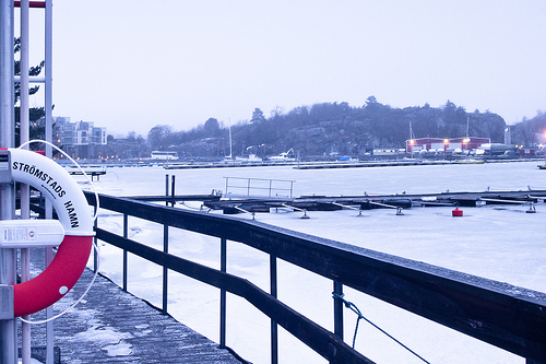
Stroemstad in the region of Västra Götaland with its 6,110 residents is a city in Sweden - some 246 mi or ( 395 km ) West of Stockholm , the country's capital .
Current time in Stroemstad is now 03:15 PM (Saturday) . The local timezone is named " Europe/Stockholm " with a UTC offset of 1 hours. Depending on your travel modalities, these larger destinations might be interesting for you: Odense, Copenhagen, Aarhus, Aalborg, and Skee. While being here, make sure to check out Odense . We encountered some video on the web . Scroll down to see the most favourite one or select the video collection in the navigation. Are you curious about the possible sightseeing spots and facts in Stroemstad ? We have collected some references on our attractions page.
Videos
Strömstad, Sweden
Harbour of Strömstad on 26th April 2007 ..
Lagunen Camping & Stugor Strömstad
A beautiful campsite by the sea. Most of the pitches with a stunning oceanview. Only 3 km to the city of Strömstad. You have to visit the wonderful Koster islands. ..
Lobster fishing in Strömstad
Lobster fishing on a crisp day in november with my father in law and brother in law. Film and still images shot entirely with a Nikkor 10.5mm f/2.8 fisheye lens on a Nikon D90 dSLR body. Footage is pr ..
Sweden 2007 - Part 2
Vänern is such a beautiful lake! :) Smögen is pretty too :D Photos: By me Part 1: www.youtube.com Part 3: www.youtube.com Thanks for watching! :D ..
Videos provided by Youtube are under the copyright of their owners.
Interesting facts about this location
Strömstad Municipality
Strömstad Municipality (Strömstads kommun) is a municipality in Västra Götaland County in western Sweden. Its seat is located in the city of Strömstad. The municipality got its present boundaries in 1967, when the City of Strömstad was merged with the two adjacent rural municipalities Tjärnö and Vette. Vette had been created in 1952 out of four older entities.
Located at 58.93 11.17 (Lat./Long.); Less than 1 km away
Herføl
Herføl is a populated island in the municipality of Hvaler, Norway. The island is 1,9 km² and has the postal code 1690.
Located at 59.00 11.05 (Lat./Long.); Less than 10 km away
Koster Islands
The Koster Islands situated 10 km west of Strömstad, Sweden, comprises an archipelago surrounding the two largest islands, South Koster and North Koster. South Koster has an area of 8 km² and North Koster an area of 4 km². The landscape, dominated by smooth bedrock, bears witness to volcanic activity and subsequent wear due to the Ice Age. The rocky coastline is broken by many sandy beaches the largest being Kilesand on South Koster's east side overlooking the 200 meter deep Koster Fjord.
Located at 58.88 11.00 (Lat./Long.); Less than 12 km away
Stora Drammen
Stora Drammen is the westernmost point of Sweden. It is an islet northwest of Kosteröarna, off Strömstad in Bohuslän. Its location is {{#invoke:Coordinates|coord}}{{#coordinates:58|56|N|10|58|E||| | |name= }}.
Located at 58.93 10.97 (Lat./Long.); Less than 12 km away
Lauer, Norway
Lauer is a small island in the Hvaler municipality in South-East Norway. The Hvaler islands are located in the Oslofjord, not far from the border with Sweden. The name "Lauer" is derived from Old Norse "Laufey", "the leafy island". Laufey was a giantess. The island was first settled in the 17th century. Today, there are around 30 homes on Lauer, used as vacation homes in the summer only. Up until the 1980s, the island was inhabited all year round. There is a cottage for hire on the island.
Located at 59.01 11.01 (Lat./Long.); Less than 12 km away
Pictures

Historical Weather
Related Locations
Information of geographic nature is based on public data provided by geonames.org, CIA world facts book, Unesco, DBpedia and wikipedia. Weather is based on NOAA GFS.