-
You are here:
- Homepage »
- Thailand »
- Phuket Province » Ban Kata

Ban Kata Destination Guide
Delve into Ban Kata in Thailand
Ban Kata in the region of Phuket Province is located in Thailand - some 436 mi or ( 702 km ) South of Bangkok , the country's capital .
Local time in Ban Kata is now 04:03 PM (Monday) . The local timezone is named " Asia/Bangkok " with a UTC offset of 7 hours. Depending on your mobility, these larger destinations might be interesting for you: Talat Yai, Wiang Sa, Surat Thani, Phuket, and Nakhon Si Thammarat. While being here, you might want to check out Talat Yai . We discovered some clip posted online . Scroll down to see the most favourite one or select the video collection in the navigation. Are you curious about the possible sightseeing spots and facts in Ban Kata ? We have collected some references on our attractions page.
Videos
Phuket beach
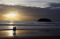
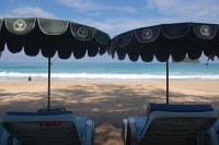
this is a picture from Kata beach in Phuket.if you can see how strong of the wave... it's none stop.... ..
Phuket Kata Beach - Activities
www.phuket-boomerang.com Boomerang Village Phuket...Very Congenial and Relaxing Ambience, Your relaxing holiday will resemble your dreams. Website www.phuket-boomerang.com http www.facebook.com www.yo ..
Canoe Trip Phang Nga Phuket Thailand
www.phuket-boomerang.com The Boomerang Village Resort is an excellent choice for a quiet relaxing stay on Phuket island. Boomerang Village Resort is situated on Kata hill side, with panoramic views of ..
Boomerang Village Resort (Phuket) - Phuket 2007
www.phuket-boomerang.com Located in the suggestive surroundings of Kata Beach, Phuket, the Boomerang Village Resort (Phuket) hotel offers a warm welcoming as well as an attentive service to all its gu ..
Videos provided by Youtube are under the copyright of their owners.
Interesting facts about this location
Kata Noi
Kata Noi is a beach on the southwestern side of the island of Phuket in Thailand. It prolongs the Kata Beach to the south. The beach is bordered to the north by the Mon Tri's Villa Royale resort, and most of the beachfront is occupied by the resort of Kata Thani.
Located at 7.81 98.30 (Lat./Long.); Less than 2 km away
Wat Chalong
The most important of the 29 buddhist temples of Phuket is Wat Chalong (Thai: วัดฉลอง or วัดไชยธาราราม), located in the tambon Chalong, Mueang Phuket district. It is dedicated to two highly venerable monks, Luang Pho Chaem (หลวงพ่อแช่ม) and Luang Pho Chuang (หลวงพ่อช่วง), who with their knowledge of herbal medicine helped the injured of a tin miners rebellion in 1876.
Located at 7.85 98.34 (Lat./Long.); Less than 4 km away
Karon Beach
Karon Beach refers to a beach, and the town adjoining it, on the western coast of Phuket, Thailand. The beach is a popular destination for tourists. Generally quieter than neighbouring Patong Beach, it is especially popular among families and couples, and less popular with singles than Patong. It is also especially popular with Scandinavian tourists, with many businesses catering especially to them.
Located at 7.86 98.29 (Lat./Long.); Less than 5 km away
Patong
Patong refers to the beach and town on Phuket's west coast. It is the main tourist resort in Phuket, and contains an important center of Phuket's nightlife and shopping. The beach became popular with Western tourists, especially Europeans, in the late 1980s. Numerous hotels are located there and the area has expanded into a large tourist mecca.
Located at 7.89 98.29 (Lat./Long.); Less than 8 km away
Surakul Stadium
Surakul Stadium is a multi-purpose stadium in Phuket Province, Thailand. It is currently used mostly for football matches. The stadium holds 15,000 and was built in 1959. The stadium co-hosted the 2008 AFF Suzuki Cup. The use of the Surakul Stadium for this tournament had to be hastily arranged. Stadiums in Bangkok were intended to be used but because of the airport takeovers in Bangkok by the PAD the AFF in consultation with the FAT decided to switch venues.
Located at 7.89 98.37 (Lat./Long.); Less than 10 km away
Pictures
Historical Weather
Related Locations
Information of geographic nature is based on public data provided by geonames.org, CIA world facts book, Unesco, DBpedia and wikipedia. Weather is based on NOAA GFS.

