-
You are here:
- Homepage »
- United Kingdom »
- England » Felixstowe

Felixstowe Destination Guide
Touring Felixstowe in United Kingdom
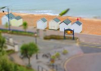
Felixstowe in the region of England with its 29,349 citizens is a city located in United Kingdom - some 71 mi or ( 114 km ) North-East of London , the country's capital city .
Time in Felixstowe is now 10:49 PM (Wednesday) . The local timezone is named " Europe/London " with a UTC offset of 0 hours. Depending on your travel resources, these more prominent places might be interesting for you: Woodbridge, Walton-on-the-Naze, Shotley Gate, Playford, and Norwich. Being here already, consider visiting Woodbridge . We collected some hobby film on the internet . Scroll down to see the most favourite one or select the video collection in the navigation. Check out our recommendations for Felixstowe ? We have collected some references on our attractions page.
Videos
Celtic Dream
Call the Box Office on 01394 282126 now to book. Celtic Dream will be appearing at the Spa Pavilion Theatre Felixstowe on Thursday 15th March 2012 at 7.30pm. Celtic Dream is one of the most original & ..
Mike's wheelchair-friendly motorhome
Mike Hervey-Murray has been in a wheelchair for 50 years - so when he wanted a motorhome to suit his needs, he knew exactly what he needed . . ..
Proposed Olympic Torch route for Felixstowe, 5th July 2012
This the is the proposed route that the Torch will take on the 5th July 2012. There are at least 10 empty businesses and shops on this route, along with the derelict sites at the Ordnance Hotel, Yacht ..
Alexanders International School Jingles's photos around Bawdsey Mannor, United Kingdom
Preview of Jingles's blog at TravelPod. Read the full blog here: www.travelpod.com This blog preview was made by TravelPod using the TripAdvisor™ TripWow slideshow creator. Learn more about these vide ..
Videos provided by Youtube are under the copyright of their owners.
Interesting facts about this location
Felixstowe & Walton United F.C
Felixstowe and Walton United F.C. is an English football club based in Felixstowe, Suffolk. Formed in 2000 by a merger of Felixstowe Port & Town and Walton United, the club are currently members of the Eastern Counties League Premier Division and play at Dellwood Avenue.
Located at 51.97 1.36 (Lat./Long.); Less than 1 km away
Trimley railway station
Trimley railway station is in the village of Trimley St Mary, near Felixstowe, in Suffolk, England, and also serves the adjacnet Trimley St Martin. The station is situated on the Felixstowe Branch Line 15.64 miles east of Ipswich. It was opened by the Great Eastern Railway (GER) in 1891. A branch line for goods trains to the Port of Felixstowe was opened in 1987. Passenger trains in 2012 are operated by Greater Anglia.
Located at 51.98 1.32 (Lat./Long.); Less than 3 km away
HMS Gipsy (H63)
HMS Gipsy (H63) was a G-class destroyer built for the Royal Navy during the 1930s. She spent most of the pre-war period as part of the Mediterranean Fleet. The ship was transferred to the British Isles to escort shipping in local waters shortly after the beginning of World War II. Less than a month after her arrival she struck a mine outside Harwich and sank with the loss of 30 of her crew. Her wreck was salvaged and slowly scrapped over the course of the war.
Located at 51.95 1.32 (Lat./Long.); Less than 3 km away
Port of Felixstowe
The Port of Felixstowe, in Felixstowe, Suffolk is the United Kingdom's busiest container port, dealing with over 40% of Britain's containerised trade. In 2011, it was ranked as the 35th busiest container port in the world and Europe's sixth busiest. The port handled 3.74 million twenty-foot equivalent units (TEU) of traffic in 2011.
Located at 51.95 1.31 (Lat./Long.); Less than 3 km away
Landguard Fort
Built just outside Felixstowe, Suffolk, at the mouth of the River Orwell, Landguard Fort was designed to guard the entrance to Harwich. The first fortifications from 1540 were a few earthworks and blockhouse, but it was James I of England who ordered the construction of a square fort with bulwarks at each corner.
Located at 51.94 1.32 (Lat./Long.); Less than 3 km away
Pictures
Historical Weather
Related Locations
Information of geographic nature is based on public data provided by geonames.org, CIA world facts book, Unesco, DBpedia and wikipedia. Weather is based on NOAA GFS.

