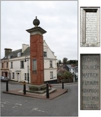
-
You are here:
- Homepage »
- United Kingdom »
- England » Sidmouth

Sidmouth Destination Guide
Delve into Sidmouth in United Kingdom
Sidmouth in the region of England with its 11,853 residents is located in United Kingdom - some 146 mi or ( 236 km ) South-West of London , the country's capital .
Local time in Sidmouth is now 01:34 PM (Monday) . The local timezone is named " Europe/London " with a UTC offset of 0 hours. Depending on your mobility, these larger destinations might be interesting for you: Talaton, Swansea, Southleigh, Plymtree, and Plymouth. While being here, you might want to check out Talaton . We discovered some clip posted online . Scroll down to see the most favourite one or select the video collection in the navigation. Are you curious about the possible sightseeing spots and facts in Sidmouth ? We have collected some references on our attractions page.
Videos
River Sid floods in The Byes Sidmouth 7th July 2012
The River Sid burst its banks and flooded large areas of The Byes Riverside Parkland in Sidmouth, Devon. July 7th 2012 For some photos have a look at the Friends of The Byes Facebook page: www.faceboo ..
Flooding in Sidmouth - 7th July 2012.
Following a month's rain in one night, the River Sid burst its banks. These pictures and video show the ford near the mouth of the river. Needless to say, the ford was closed to vehicles!! ..
Hymer motorhome guide
A guide to one of the greatest and most iconic motorhomes ever made. The Hymer B534, ultra reliable and very well built. There are other variations of the B534, but this is the version and layout that ..
Sidmouth Flooding
Filmed July 7th 2012 in Sidmouth Devon. This is a river walk through the Byes showing the river Sid bursting its banks leading to the sea. ..
Videos provided by Youtube are under the copyright of their owners.
Interesting facts about this location
Sidmouth railway station
Sidmouth railway station was a fully operational single platform station located in Sidmouth, Devon, England until its closure in 1967. The station is now a privately owned property at the top of Alexandria Road, Sidmouth. The line was part of the Southern Railway, a branch off the Salisbury to Exeter route. Its railway heritage is still clear, as can be seen from the photograph of the front of the building. Round the back there is still some platform and canopy, in use by a builders' merchant.
Located at 50.69 -3.25 (Lat./Long.); Less than 0 km away
East Devon
East Devon is a local government district in Devon, England. Its council is based in Sidmouth, and the largest town is Exmouth. The district was formed on 1 April 1974 by the merger of the borough of Honiton with the urban districts of Budleigh Salterton, Exmouth, Ottery St. Mary, Seaton, Sidmouth along with Axminster Rural District, Honiton Rural District and part of St. Thomas Rural District. East Devon is covered by two Parliamentary constituencies, East Devon and Tiverton and Honiton.
Located at 50.68 -3.24 (Lat./Long.); Less than 1 km away
Lockyer Observatory and Planetarium
The Norman Lockyer Observatory and Planetarium (NLO) is a planetarium and a public access optical observatory in East Devon on the Jurassic Coast of South West England.
Located at 50.69 -3.22 (Lat./Long.); Less than 2 km away
Sidbury Castle
Sidbury Castle is a substantial Iron Age hill fort near Sidbury in Devon, England. It occupies a large hilltop overlooking the town and the River Sid at approximately 185 metres above sea level.
Located at 50.71 -3.24 (Lat./Long.); Less than 3 km away
The Donkey Sanctuary
The Donkey Sanctuary is a British charitable organisation devoted to the welfare of donkeys. The charity, which is based near Sidmouth in Devon, England, was founded in 1969. It is one of the largest equine charities in the world with an annual income and expenditure of £22 million.
Located at 50.70 -3.19 (Lat./Long.); Less than 4 km away
Pictures
Related Locations
Information of geographic nature is based on public data provided by geonames.org, CIA world facts book, Unesco, DBpedia and wikipedia. Weather is based on NOAA GFS.


