-
You are here:
- Homepage »
- United States »
- California » Madison

Madison Destination Guide
Delve into Madison in United States
Madison in the region of California with its 503 residents is a city in United States - some 2,395 mi or ( 3854 km ) West of Washington , the country's capital .
Current time in Madison is now 02:07 AM (Wednesday) . The local timezone is named " America/Los Angeles " with a UTC offset of -7 hours. Depending on your travel modalities, these larger destinations might be interesting for you: Bakersfield, Dufour, El Rio Villa, Fresno, and Modesto. While being here, make sure to check out Bakersfield . We encountered some video on the web . Scroll down to see the most favourite one or select the video collection in the navigation. Are you curious about the possible sightseeing spots and facts in Madison ? We have collected some references on our attractions page.
Videos
Capay Tomato Festival
Join us on our Capay Organic Farm, Saturday Evening, July 14th from 3 pm to 11 pm, for a summer celebration of all things tomato! Enjoy organic, heirloom and cherry tomato tasting, live music and danc ..
january cruise on 505 south
me matt cyle havin alil fun coming home on 505 ..
First Skydive
Wanted to do this ever since I watched Point Break :) ..
Long cross country flight to Yolo (KDWA)
My flight from Castle (KMER) to Yolo Davis (KDWA) Alarus CH2T (N282AM) Thanks for watching ..
Videos provided by Youtube are under the copyright of their owners.
Interesting facts about this location
Cottonwood, Yolo County, California
Cottonwood is a former settlement in Yolo County, California. It was located 2 miles south of Madison, at an elevation of 164 feet (50 m). It still appears on maps as of 1917.
Located at 38.66 -121.97 (Lat./Long.); Less than 2 km away
Rancho Cañada de Capay
Rancho Cañada de Capay was a 40,079-acre Mexican land grant in present day Yolo County, California given in 1846 by Governor Pío Pico to the three brothers Santiago, Nemicio, and Francisco Berreyesa. "Cañada de Capay" means "valley of the Capay" in Spanish. "Capay" comes from the Southern Wintun Indian word for "stream". The rancho occupied the Capay Valley on both sides of Cache Creek.
Located at 38.70 -121.96 (Lat./Long.); Less than 2 km away
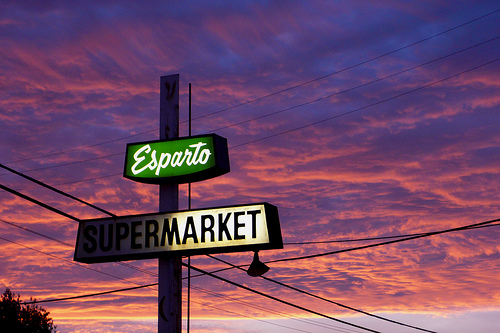
Esparto, California
Esparto (formerly Esperanza) is a census-designated place (CDP) in Yolo County, California, United States. It is part of the Sacramento–Arden-Arcade–Roseville Metropolitan Statistical Area. The population was 3,108 at the 2010 census.
Located at 38.69 -122.02 (Lat./Long.); Less than 5 km away
Rancho Quesesoni
Rancho Quesesoni (also called "Gordon's Ranch") was a 8,894-acre Mexican land grant in present day Yolo County, California given in 1843 by Governor Manuel Micheltorena to William Gordon. The grant, west of Woodland, extended 2 leagues along both sides of Rio de Jesús María, now known as Cache Creek. The grant was between Rancho Cañada de Capay on the west, and Rancho Rio de Jesus Maria on the east.
Located at 38.70 -121.92 (Lat./Long.); Less than 5 km away
Citrona, California
Citrona is an unincorporated community in Yolo County, California. It is located on the Southern Pacific Railroad 3 miles south of Madison, at an elevation of 164 feet (50 m).
Located at 38.63 -121.97 (Lat./Long.); Less than 5 km away
Pictures
Related Locations
Information of geographic nature is based on public data provided by geonames.org, CIA world facts book, Unesco, DBpedia and wikipedia. Weather is based on NOAA GFS.