-
You are here:
- Homepage »
- United States »
- California » Rolling Hills

Rolling Hills Destination Guide
Delve into Rolling Hills in United States
Rolling Hills in the region of California with its 1,860 residents is located in United States - some 2,307 mi or ( 3713 km ) West of Washington , the country's capital .
Local time in Rolling Hills is now 11:20 PM (Monday) . The local timezone is named " America/Los Angeles " with a UTC offset of -7 hours. Depending on your mobility, these larger destinations might be interesting for you: Bakersfield, Carson, Compton, Fresno, and Hawthorne. While being here, you might want to check out Bakersfield . We discovered some clip posted online . Scroll down to see the most favourite one or select the video collection in the navigation. Are you curious about the possible sightseeing spots and facts in Rolling Hills ? We have collected some references on our attractions page.
Videos
2011 Specialized Stumpjumper Comp Carbon 29er Mountain Bike at PV Bicycle Center
Come in and test ride. Just three miles from Torrance, Lomita, and Redondo Beach, and located in the 4 city are of Rancho Palos Verdes, Rolling Hllls, Rolling Hills Estates, and Palos Verdes Estates, ..
Abalone Cove Tidepool Exploring
Southern California is known for its miles of sandy beaches. But many Angelinos may be less familiar with the rocky, rugged coastlines of Palos Verdes. Here is an excellent place to get outside and ex ..
Happy Hoofers Equestrian Drill Team 2008 RHE City Celeb
The Happy Hoofers Equestrian Drill Team performaing at the RHE City Celebration on Sept. 20, 2008 at the Empty Saddle Club in Rolling Hills Estates. ..
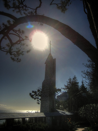
30 Wayfarers Chapel
3 weeks RV tour beside the beaten track Part 30 of 30 Wayfarers Chapel US National Register of Historic Places Location: 5755 Palos Verdes Dr. S Rancho Palos Verdes, California Coordinates: 33°44′37.1 ..
Videos provided by Youtube are under the copyright of their owners.
Interesting facts about this location
Palos Verdes
IT'S THE EPIC! Palos Verdes is a group of coastal cities in the Palos Verdes Hills on the Palos Verdes Peninsula, within southwestern Los Angeles County in the U.S. state of California. The Palos Verdes Peninsula cities include Palos Verdes Estates, Rancho Palos Verdes, Rolling Hills and Rolling Hills Estates. The peninsula is an affluent community known for its dramatic ocean and city views from the Palos Verdes Hills, distinguished schools, extensive horse trails, and high home prices.
Located at 33.76 -118.35 (Lat./Long.); Less than 1 km away
Rancho Palos Verdes, California
Rancho Palos Verdes (sometimes abbreviated RPV) is a city in Los Angeles County, California, that was incorporated on September 7, 1973. The population was 41,643 at the 2010 census. Rancho Palos Verdes translates from Spanish as Green Mast Farm or Green Pole Farm, referring to the North American tree species Parkinsonia florida (blue palo verde). Rancho Palos Verdes is an affluent suburb of Los Angeles.
Located at 33.76 -118.36 (Lat./Long.); Less than 1 km away
Rolling Hills, California
Rolling Hills is a city in the Palos Verdes Hills, in Los Angeles County, California, United States. As of the 2010 census, the city population was 1,860, down from 1,871 at the 2000 census. According to the 2000 US Census, Rolling Hills is the 21st richest place in the United States, and #4 for places with a population of at least 1,000. Rolling Hills consists of a single gated community.
Located at 33.76 -118.34 (Lat./Long.); Less than 1 km away
Portuguese Bend
The Portuguese Bend region is the largest area of natural vegetation remaining on the Palos Verdes Peninsula, in Los Angeles County, California. Though once slated for development (and in fact the projected route of Crenshaw Boulevard through the area still shows on many maps), the area is geologically unstable and is unsuitable for building.
Located at 33.75 -118.36 (Lat./Long.); Less than 1 km away
Rolling Hills Estates, California
Rolling Hills Estates is a city in Los Angeles County, California, United States. The population was 8,067 at the 2010 census, up from 7,676 at the 2000 census. On the northern side of the Palos Verdes Peninsula, facing Torrance, Rolling Hills Estates is mostly residential. Incorporated in 1957, Rolling Hills Estates tries to maintain a fairly bucolic character with a large number of horse paths.
Located at 33.77 -118.36 (Lat./Long.); Less than 2 km away
Pictures

Related Locations
Information of geographic nature is based on public data provided by geonames.org, CIA world facts book, Unesco, DBpedia and wikipedia. Weather is based on NOAA GFS.