-
You are here:
- Homepage »
- United States »
- Hawaii » He'eia

He'eia Destination Guide
Explore He'eia in United States
He'eia in the region of Hawaii with its 4,963 inhabitants is a place in United States - some 4,821 mi or ( 7759 km ) West of Washington , the country's capital city .
Time in He'eia is now 09:11 AM (Wednesday) . The local timezone is named " Pacific/Honolulu " with a UTC offset of -10 hours. Depending on your budget, these more prominent locations might be interesting for you: Kahalu'u, Kane'ohe, Kokokahi, Lihue, and Mahinui. Since you are here already, consider visiting Kahalu'u . We saw some hobby film on the internet . Scroll down to see the most favourite one or select the video collection in the navigation. Where to go and what to see in He'eia ? We have collected some references on our attractions page.
Videos
Kapunahala Elementary School in Kaneohe, Hawaii, or How I Found My Rainbowman
Through the magic & power of Google Earth satellites, you can zoom in almost anywhere. Here, I found something I had lost back in my school days. Lyrics to "Rainbowman", which ran from October 6, 1972 ..
Hawaii Fireworks New Years 2009
The Fireworks in Hawaii are incredible, these are all by the neighbors, no professional displays here. The smoke from the works was so intense I could not see my neighbors house across the street. I s ..
Kaneohe Sandbar - August 31, 2008
My first trip out to the Kaneohe Sandbar - August 31, 2008. ..
View from the top of Stairway to Heaven on the island of Oahu in Hawaii
View from the top of the Stairway to Heaven Hike. Probably one of the most magnificant views on Oahu, maybe even in Hawaii? Getting to the stairs can be problematic as most routes take you over privat ..
Videos provided by Youtube are under the copyright of their owners.
Interesting facts about this location
Heʻeia, Hawaii
Heʻeia is a census-designated place comprising several neighborhoods located in the City & County of Honolulu and the Koʻolaupoko District on the island of Oʻahu north of Kāneʻohe. In Hawaiian the words heʻe ʻia mean "washed away", alluding to a victory achieved by the populace against others from leeward Oʻahu, aided by a tsunami that washed the combatants off the shore. Heʻeia includes Haʻikū Valley and Heʻeia Kea. The population was 4,963 at the 2010 census.
Located at 21.43 -157.81 (Lat./Long.); Less than 1 km away
Byodo-In Temple
The Byodo-In Temple is a non-denominational Buddhist temple located on the island of O'ahu in Hawai'i at the Valley of the Temples. At 47-200 Kahekili Highway, the Byodo-In Temple is a replica of a 900-year-old Buddhist place of worship at Uji in Kyoto prefecture of Japan. Inside the Byodo-In Temple is a nine-foot (3 m) Lotus Buddha, a wooden Buddha. It is covered in gold and lacquer. Outside is a three-ton, brass peace bell.
Located at 21.43 -157.83 (Lat./Long.); Less than 2 km away
Coconut Island
Coconut Island, or Moku o Loʻe, is a 28-acre (113,000 m²) island in Kāne'ohe Bay off the island of O'ahu in the state of Hawai'i, USA. It is a marine research facility of the Hawai`i Institute of Marine Biology (HIMB) of the University of Hawai`i. In 1934–1936, Christian Holmes II, an heir to the Fleischmann yeast fortune, doubled the original 12-acre island with coral rubble, sand, and earthen landfill. He established a residence with aquaria, kennels, and aviaries for his many pets.
Located at 21.43 -157.79 (Lat./Long.); Less than 2 km away
Kaneohe, Hawaii
Kāneʻohe is a census-designated place (CDP) included in the City and County of Honolulu and located in Hawaiʻi state District of Koʻolaupoko on the island of Oʻahu. In the Hawaiian language, kāne ʻohe means "bamboo man". According to an ancient Hawaiian story a local woman compared her husband's cruelty to the sharp edge of cutting bamboo; thus the place was named Kāneʻohe or "Bamboo man". The population was 34,597 at the 2010 census.
Located at 21.41 -157.80 (Lat./Long.); Less than 3 km away
Kāneʻohe Bay
Kāneʻohe Bay, at 45 km², is the largest sheltered body of water in the main Hawaiian Islands. This reef-dominated embayment constitutes a significant scenic and recreational feature along the windward (northeast) coast of the Island of Oʻahu. The largest population center on Kāneʻohe Bay is the town of Kāneʻohe. The Bay is approximately 8 mi (12.8 km) long and 2.7 mi (4.3 km) broad, with a mouth opening of about 4.6 mi (7.4 km) and maximum depth of 40 ft (12 m) in the dredged channel.
Located at 21.46 -157.80 (Lat./Long.); Less than 3 km away
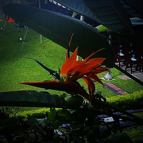
Pictures
Related Locations
Information of geographic nature is based on public data provided by geonames.org, CIA world facts book, Unesco, DBpedia and wikipedia. Weather is based on NOAA GFS.