-
You are here:
- Homepage »
- United States »
- Maine » Princeton

Princeton Destination Guide
Explore Princeton in United States
Princeton in the region of Maine with its 927 inhabitants is a town in United States - some 653 mi or ( 1050 km ) North-East of Washington , the country's capital city .
Current time in Princeton is now 08:00 AM (Sunday) . The local timezone is named " America/New York " with a UTC offset of -4 hours. Depending on the availability of means of transportation, these more prominent locations might be interesting for you: Boston, Alexander, Bangor, Bingo, and Ellsworth. Since you are here already, make sure to check out Boston . We encountered some video on the web . Scroll down to see the most favourite one or select the video collection in the navigation. Where to go and what to see in Princeton ? We have collected some references on our attractions page.
Videos
Below the Surface
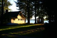
Underwater footage of our smallmouth trip to Down River Camps in Princeton, Maine. The lake was loaded with bait (alewives) and getting them to eat artificials was tougher than expected. Downsizing ou ..
Crab Boil!
Crab Boil! ..
Washington County 2012: Pinceton, Maine - Worksite Clips
Extra clips from the Washington County trip I went on with Stroudwater Christian Church. ..
Washington County 2012: Pinceton, Maine - Camp Clips
Extra clips from the Washington County trip I went on with Stroudwater Christian Church. ..
Videos provided by Youtube are under the copyright of their owners.
Interesting facts about this location
Princeton, Maine
Princeton is a town in Washington County, Maine, United States. The town was named after Princeton, Massachusetts. The population was 832 at the 2010 census.
Located at 45.22 -67.57 (Lat./Long.); Less than 0 km away
Princeton Municipal Airport (Maine)
Princeton Municipal Airport is a town-owned public-use airport located two nautical miles south of the central business district of Princeton, a town in Washington County, Maine, United States.
Located at 45.20 -67.56 (Lat./Long.); Less than 3 km away
Passamaquoddy people
The Passamaquoddy (Peskotomuhkati or Pestomuhkati in the Passamaquoddy language) are the First Nations (Native American) people who live in northeastern North America, primarily in Maine and New Brunswick. The Passamaquoddy had a purely oral history before the arrival of Europeans, occupied coastal regions along the Bay of Fundy and Gulf of Maine and along the St. Croix River and its tributaries.
Located at 45.27 -67.61 (Lat./Long.); Less than 6 km away
New Brunswick Route 725
Route 725 is a 19.2-kilometre long mostly north-south secondary highway in the southwestern portion of New Brunswick, Canada. Most of the route is in Charlotte County. The route starts at a dead end at the Canada-US Border northwest of Upper Little Ridge. The road travels southeast through a mostly forested area to the southern terminus of Route 730 then through the communities of Upper Little Ridge, Little Ridge, and Lower Little Ridge.
Located at 45.21 -67.40 (Lat./Long.); Less than 13 km away
Little River (Big Lake)
The Little River is a short river in Maine. From the outflow of Little River Lake in T.47 MD BPP, the river runs 7.1 miles southeast and northeast to Big Lake in T.27 ED BPP. Little River and its main tributary, Grand Lake Brook, provide an alternate drainage from West Grand Lake to Big Lake, in parallel to Grand Lake Stream. Big Lake drains into the Grand Falls Flowage, a reservoir created by the Grand Falls Dam on the St. Croix River in Baileyville.
Located at 45.15 -67.73 (Lat./Long.); Less than 15 km away
Pictures
Related Locations
Information of geographic nature is based on public data provided by geonames.org, CIA world facts book, Unesco, DBpedia and wikipedia. Weather is based on NOAA GFS.


