-
You are here:
- Homepage »
- United States »
- Texas » Texas City

Texas City Destination Guide
Delve into Texas City in United States
Texas City in the region of Texas with its 45,099 residents is a city in United States - some 1,211 mi or ( 1949 km ) South-West of Washington , the country's capital .
Current time in Texas City is now 05:10 PM (Thursday) . The local timezone is named " America/Chicago " with a UTC offset of -5 hours. Depending on your travel modalities, these larger destinations might be interesting for you: Anderson Ways, Angleton, Austin, Bacliff, and Beaumont. While being here, make sure to check out Anderson Ways . We encountered some video on the web . Scroll down to see the most favourite one or select the video collection in the navigation. Are you curious about the possible sightseeing spots and facts in Texas City ? We have collected some references on our attractions page.
Videos
The Texas City Dike - Ike
The dike/fishing pier devastation after Ike. It is the longest man-made drivable pier in the world. ..
Mosquito Island TX City Dike - Capt. Joe Kent 9/23/11
Mosquito Island in Texas City is a great place for wade and kayak fishing. Capt. Joe Kent discusses the location's advantages, dangers and the impending golden croaker and flounder runs. Watch now for ..
UNDER THE FLAGSHIP HOTEL GALVESTON,TEXAS
DAMAGE TO THE PIERS FROM HURRICANE IKE ..
Ball High Golden Tornado Marching Band
Ball High School Marching Band ..
Videos provided by Youtube are under the copyright of their owners.
Interesting facts about this location
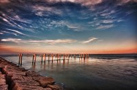
Texas City Dike
The Texas City Dike is a levee located in Texas City, TX that projects nearly 5 miles south-east into the mouth of Galveston Bay. It is flanked by the north-eastern tip of Galveston Island and the south-western tip of the Bolivar Peninsula. The dike, one of the area's most beloved and enduring landmarks, was originally designed to reduce the impact of sediment accumulation along the lower Bay.
Located at 29.39 -94.89 (Lat./Long.); Less than 2 km away
Texas City Refinery explosion
On March 23, 2005, a fire and explosion at BP's Texas City Refinery in Texas City, Texas killed 15 workers and injured more than 170. The Texas City Refinery was the second-largest oil refinery in the state, and the third-largest in the United States with an input capacity of 437,000 barrels per day as of January 1, 200. BP acquired the Texas City refinery as part of its merger with Amoco in 1998. The explosion occurred in an isomerization unit.
Located at 29.37 -94.93 (Lat./Long.); Less than 3 km away
Texas City, Texas
Texas City is a city in Chambers and Galveston counties in the US state of Texas. Located on the southwest shoreline of Galveston Bay, Texas City is a busy deepwater port on Texas' Gulf Coast, as well as a petroleum refining and petrochemical manufacturing center. The population was 45,099 at the 2010 census, making it the third-largest city in Galveston County, behind League City and Galveston. It is a part of the Houston–Sugar Land–Baytown metropolitan area.
Located at 29.40 -94.93 (Lat./Long.); Less than 4 km away
Galveston County, Texas
Galveston County is a county located in the U.S. state of Texas within the Houston–Sugar Land–Baytown metropolitan area. As of the 2010 census, the population was 291,309. Its county seat is Galveston. League City is the largest city in Galveston County in terms of population; http://news. galvestondailynews. com/story. lasso?ewcd=cecba57d52dda271 between 2000 and 2005 it surpassed Galveston as the county's largest city. Galveston County was founded in 1838.
Located at 29.38 -94.86 (Lat./Long.); Less than 4 km away
KYST
KYST, branded as "La Nueve Veinte", is a Houston, Texas, area AM radio station that broadcasts news, information, and sports in Spanish. The station broadcasts on AM frequency 920 kHz and is under ownership of Hispanic Broadcasting, Inc.. The station went on the air in 1947 as KTLW. In the 1960s and 1970s, it aired a country music format. In 1982, while officially known as KYST, it billed itself as "Beatle Radio Number 9 KBTL" and had a format of all Beatles music.
Located at 29.42 -94.94 (Lat./Long.); Less than 5 km away
Pictures
Related Locations
Information of geographic nature is based on public data provided by geonames.org, CIA world facts book, Unesco, DBpedia and wikipedia. Weather is based on NOAA GFS.

