-
You are here:
- Homepage »
- Austria »
- Burgenland » Podersdorf am See

Podersdorf am See Destination Guide
Discover Podersdorf am See in Austria
Podersdorf am See in the region of Burgenland is a place located in Austria - some 33 mi or ( 52 km ) South-East of Vienna , the country's capital .
Local time in Podersdorf am See is now 10:32 PM (Tuesday) . The local timezone is named " Europe/Vienna " with a UTC offset of 1 hours. Depending on your mobility, these larger cities might be interesting for you: Belgrade, Winden am See, Vienna, Wallern im Burgenland, and Tadten. When in this area, you might want to check out Belgrade . We discovered some clip posted online . Scroll down to see the most favourite one or select the video collection in the navigation. Are you looking for some initial hints on what might be interesting in Podersdorf am See ? We have collected some references on our attractions page.
Videos
NOVA ROCK 2011 - Luftaufnahmen vom Festival , www.sky-message.at
Luftaufnahmen vom NOVA ROCK 2011 powered by TIGER - Coatings und sky-message (www.tiger.at, www.sky-message.at) ..
makani im Sturm, wharram Tiki 26
Wharram KATAMARAN Tiki26, Neusiedlersee, Österreich ..
Neusiedler See, Burgenland - Austria HD
www.myvideomedia.de English see below [dt.] Der Neusiedler See ist der zweitgrößte Steppensee in Europa und gehört sowohl zu Österreich als auch zu Ungarn. Die Umgebung des Sees ist seit ca. 8000 Jahr ..
HOOKED part 1 - the lake
a windsurfing movie about the local scene at lake neusiedl and vienna / austria, featuring riders from the austrian fanatic / northsails team as well as some nonprofessional riders who show you the fa ..
Videos provided by Youtube are under the copyright of their owners.
Interesting facts about this location
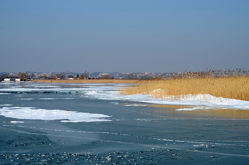
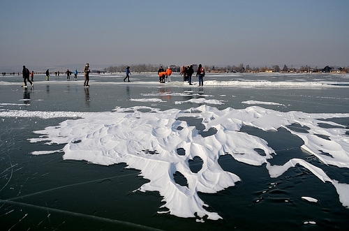
Lake Neusiedl
Lake Neusiedl or Fertő is the second largest Endorheic lake in Central Europe, straddling the Austrian–Hungarian border. The lake covers 315 km², of which 240 km² is on the Austrian side and 75 km² on the Hungarian side. The lake's drainage basin has an area of about 1,120 km². From north to south, the lake is about 36 km long, and it is between 6 km and 12 km wide from east to west. On average, the lake's surface is 115.45 m above the Adriatic Sea and the lake is no more than 1.8 m deep.
Located at 47.83 16.75 (Lat./Long.); Less than 7 km away
Neusiedl am See District
Bezirk Neusiedl am See is a district of the state of Burgenland in Austria.
Located at 47.93 16.93 (Lat./Long.); Less than 11 km away
Fertő-Hanság National Park
The Fertő-Hanság National Park (Hungarian: Fertő-Hanság Nemzeti Park) is a national Park in North-West Hungary in Győr-Moson-Sopron county. It was created in 1991, and officially opened together with the connecting Austrian Neusiedler See National Park the same year (both parks are attached to Lake Neusiedl/Lake Fertő). The park covers 235.88 km², and consists of two main areas.
Located at 47.75 16.75 (Lat./Long.); Less than 13 km away
Pan-European Picnic
The Pan-European Picnic was a peace demonstration held on the Austrian-Hungarian border near the town of Sopron on 19 August 1989, an important event during the Revolutions of 1989 that led to the fall of the Iron Curtain and the reunification of Germany. It was organised by the Paneuropean Union and the Hungarian opposition Hungarian Democratic Forum under the protection of Otto von Habsburg and Imre Pozsgay.
Located at 47.76 16.62 (Lat./Long.); Less than 19 km away
Fertőrákos
Fertőrákos is a village in the county of Győr-Moson-Sopron in Hungary. In 2001 it had a population of 2,182. It is located at {{#invoke:Coordinates|coord}}{{#coordinates:47|43|15|N|16|39|0|E|region:HU_type:city(2,182) | |name= }}, about 10 km from Sopron, near Lake Fertő and the Austrian border. In summer, a border checkpoint for pedestrians and cyclists connects it to the Austrian municipality of Mörbisch am See. The Fertorakos mithraeum is visible near the border.
Located at 47.72 16.65 (Lat./Long.); Less than 20 km away
Pictures
Historical Weather
Related Locations
Information of geographic nature is based on public data provided by geonames.org, CIA world facts book, Unesco, DBpedia and wikipedia. Weather is based on NOAA GFS.